Eichwalde night lights from space
Night Light of Eichwalde (Brandenburg) from space (Germany) Src. Average luminocity for 10x10km area is 26.1679% and for 50x50km: 27.3653%.
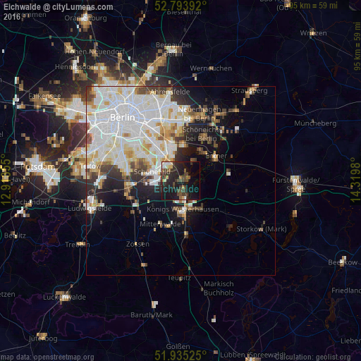
Analysis of Eichwalde night lights 2016
Square area 10x10 km:
 1.77%
1.77%90-99
3.41%80-89
1.26%70-79
2.02%60-69
1.52%50-59
3.91%40-49
8.33%30-39
7.45%20-29
11.74%10-19
35.1%0-9
23.48%Square area 50x50 km:
9.48%90-99
7.43%80-89
2.59%70-79
2.04%60-69
1.78%50-59
1.91%40-49
2.86%30-39
2.67%20-29
3.41%10-19
7.61%0-9
58.22%Clear (daylight) street map image can be seen on geolist.org.
Map coordinates:
52° 47' 38.1" North, 12° 54' 48.8" East
52° 22' 0" North, 13° 37' 0" East
51° 56' 6.9" North, 14° 19' 11.3" East
Some cities around Eichwalde sort by population:
• Königs Wusterhausen
7.3 km =4.5 mi,  171°
171°
• Altglienicke
7.4 km =4.6 mi,  311°
311°
• Schönefeld
8.1 km =5 mi,  287°
287°
• Bohnsdorf
4.3 km =2.7 mi,  316°
316°
• Zeuthen
2.1 km =1.3 mi, 170°
• Schulzendorf
1.6 km =1 mi,  232°
232°
• Müggelheim
5.9 km =3.7 mi,  32°
32°
• Grünau
6.1 km =3.8 mi,  336°
336°
2932040 (p: 5,849)
Sources (retrieved 2019-11-25):
» Earth at Night: Flat Maps 2012, 2016