Duisburg night lights from space
Night Light of Duisburg (North Rhine-Westphalia) from space (Germany) Src. Average luminocity for 10x10km area is 84.3463% and for 50x50km: 43.9059%.
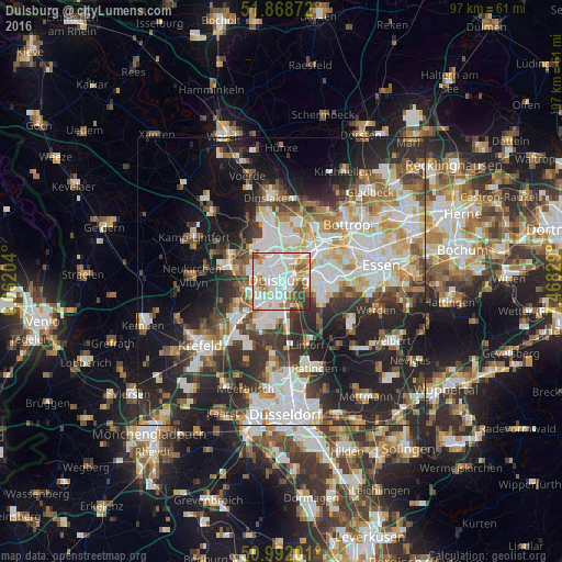
Analysis of Duisburg night lights 2016
Square area 10x10 km:
 30.75%
90-99
29.41%80-89
5.88%70-79
10.7%60-69
7.35%50-59
6.15%40-49
5.35%30-39
4.01%20-29
0.4%10-19
0%0-9
0%Square area 50x50 km:
9.89%90-99
10.23%80-89
4.69%70-79
4.7%60-69
4.85%50-59
5.15%40-49
5.06%30-39
7.01%20-29
12.7%10-19
16.62%0-9
19.09%Clear (daylight) street map image can be seen on geolist.org.
Map coordinates:
51° 52' 7.4" North, 6° 3' 43.3" East
51° 25' 56.9" North, 6° 45' 54.6" East
50° 59' 31.2" North, 7° 28' 5.8" East
Some cities around Duisburg sort by population:
• Oberhausen
8.4 km =5.2 mi,  53°
53°
• Mülheim
7.9 km =4.9 mi,  90°
90°
• Bottrop
15.2 km =9.4 mi, 48°
• Moers
9.5 km =5.9 mi,  284°
284°
• Ratingen
16.1 km =10 mi,  158°
158°
• Dinslaken
14.5 km =9 mi,  354°
354°
• Meiderich
3.8 km =2.4 mi,  1°
1°
• Hochfeld
1.6 km =1 mi,  206°
206°
2934691 (p: 504,358)
Sources (retrieved 2019-11-25):
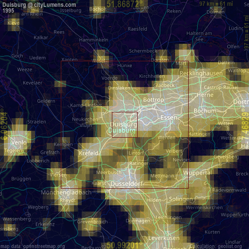
» NASA, Earths city lights 1995
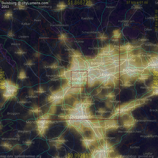
» NASA city lights 2003
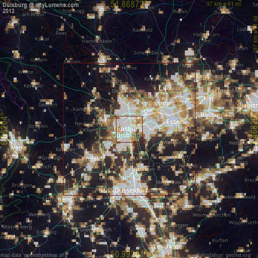
» Earth at Night: Flat Maps 2012, 2016