Mülheim night lights from space
Night Light of Mülheim (North Rhine-Westphalia) from space (Germany) Src. Average luminocity for 10x10km area is 75.4532% and for 50x50km: 50.0094%.
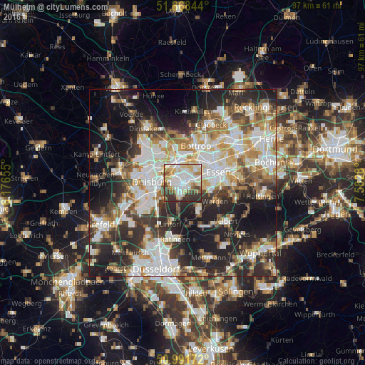
Analysis of Mülheim night lights 2016
Square area 10x10 km:
 21.66%
90-99
23.93%80-89
10.56%70-79
9.36%60-69
6.15%50-59
4.95%40-49
5.35%30-39
12.57%20-29
5.48%10-19
0%0-9
0%Square area 50x50 km:
11.29%90-99
11.8%80-89
5.45%70-79
5.65%60-69
6%50-59
6.11%40-49
5.56%30-39
7.67%20-29
13.36%10-19
16.62%0-9
10.48%Clear (daylight) street map image can be seen on geolist.org.
Map coordinates:
51° 52' 6.4" North, 6° 10' 35.6" East
51° 25' 55.8" North, 6° 52' 46.8" East
50° 59' 30.2" North, 7° 34' 58.1" East
Some cities around Mülheim sort by population:
• Essen
9.6 km =6 mi,  73°
73°
• Duisburg
7.9 km =4.9 mi,  270°
270°
• Oberhausen
5.2 km =3.2 mi,  346°
346°
• Bottrop
10.7 km =6.6 mi,  18°
18°
• Ratingen
15.2 km =9.4 mi,  188°
188°
• Meiderich
8.7 km =5.4 mi,  296°
296°
• Heiligenhaus
13.3 km =8.3 mi,  151°
151°
• Hochfeld
8.8 km =5.5 mi,  260°
260°
2867838 (p: 171,000)
Sources (retrieved 2019-11-25):
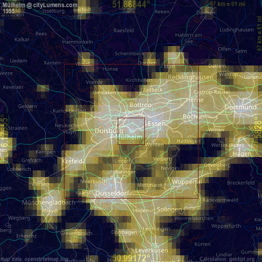
» NASA, Earths city lights 1995
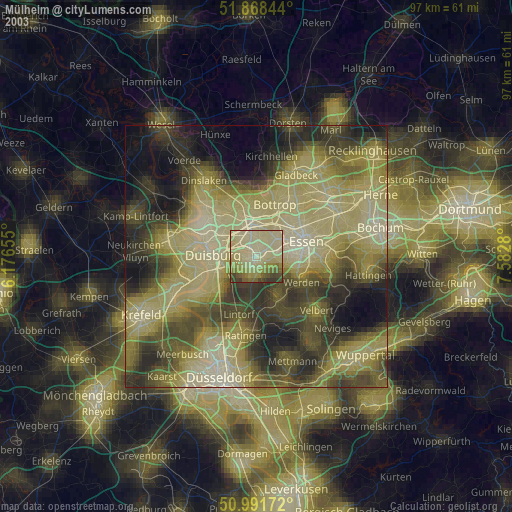
» NASA city lights 2003
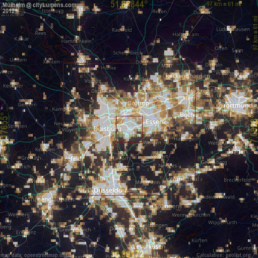
» Earth at Night: Flat Maps 2012, 2016