Bayenthal night lights from space
Night Light of Bayenthal (North Rhine-Westphalia) from space (Germany) Src. Average luminocity for 10x10km area is 82.2311% and for 50x50km: 32.5529%.
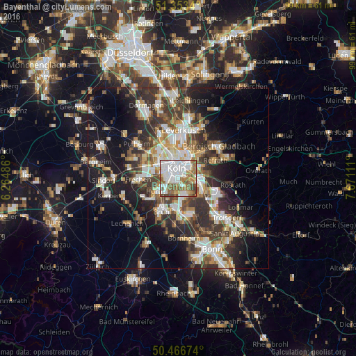
Analysis of Bayenthal night lights 2016
Square area 10x10 km:
 31.93%
90-99
24.09%80-89
5.04%70-79
3.78%60-69
15.97%50-59
11.06%40-49
6.58%30-39
1.54%20-29
0%10-19
0%0-9
0%Square area 50x50 km:
6.18%90-99
6.69%80-89
2.97%70-79
3.05%60-69
4.42%50-59
4.62%40-49
4.59%30-39
6.75%20-29
8.89%10-19
15.37%0-9
36.47%Clear (daylight) street map image can be seen on geolist.org.
Map coordinates:
51° 21' 12.2" North, 6° 15' 53.5" East
50° 54' 43.8" North, 6° 58' 4.8" East
50° 28' 0.3" North, 7° 40' 16" East
Some cities around Bayenthal sort by population:
• Köln
2.7 km =1.7 mi,  331°
331°
• Neustadt/Süd
2 km =1.2 mi,  315°
315°
• Altstadt Sud
2.4 km =1.5 mi,  345°
345°
• Kalk
4.1 km =2.5 mi,  40°
40°
• Altstadt Nord
3.1 km =1.9 mi, 346°
• Deutz
2.5 km =1.6 mi,  11°
11°
• Humboldtkolonie
2.9 km =1.8 mi, 40°
• Poll
1.6 km =1 mi,  88°
88°
2951860 (p: 8,714)
Sources (retrieved 2019-11-25):
» Earth at Night: Flat Maps 2012, 2016