Weißenthurm night lights from space
Night Light of Weißenthurm (Rheinland-Pfalz) from space (Germany) Src. Average luminocity for 10x10km area is 47.2969% and for 50x50km: 8.1662%.
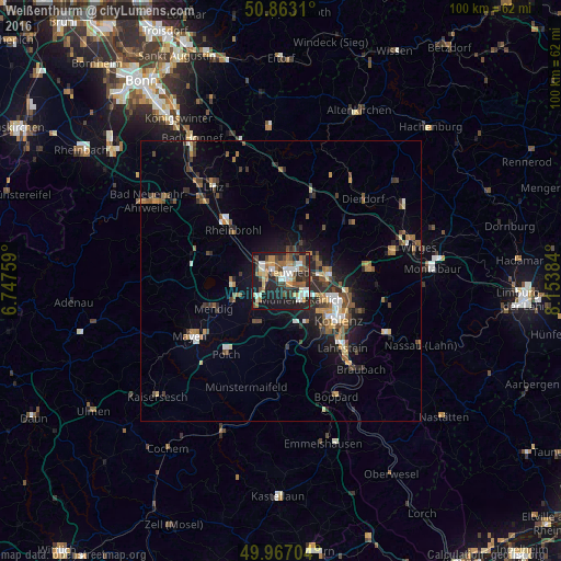
Analysis of Weißenthurm night lights 2016
Square area 10x10 km:
 7.7%
7.7%90-99
8.96%80-89
5.46%70-79
5.04%60-69
8.68%50-59
6.72%40-49
8.68%30-39
4.2%20-29
18.91%10-19
24.65%0-9
0.98%Square area 50x50 km:
0.8%90-99
1%80-89
0.73%70-79
0.75%60-69
1.35%50-59
1.44%40-49
1.63%30-39
1.19%20-29
2.48%10-19
4.98%0-9
83.63%Clear (daylight) street map image can be seen on geolist.org.
Map coordinates:
50° 51' 47.2" North, 6° 44' 51.3" East
50° 25' 1.9" North, 7° 27' 2.6" East
49° 58' 1.3" North, 8° 9' 13.8" East
Some cities around Weißenthurm sort by population:
• Koblenz
11.5 km =7.1 mi,  127°
127°
• Neuwied
2.3 km =1.4 mi,  37°
37°
• Andernach
3.6 km =2.2 mi,  295°
295°
• Bendorf
9.1 km =5.7 mi,  86°
86°
• Mülheim-Kärlich
4.9 km =3 mi,  136°
136°
• Vallendar
12.5 km =7.8 mi,  100°
100°
• Plaidt
4.9 km =3 mi,  236°
236°
• Ochtendung
8.9 km =5.5 mi,  212°
212°
2811837 (p: 7,639)
Sources (retrieved 2019-11-25):
» Earth at Night: Flat Maps 2012, 2016