Bad Lippspringe night lights from space
Night Light of Bad Lippspringe (North Rhine-Westphalia) from space (Germany) Src. Average luminocity for 10x10km area is 11.402% and for 50x50km: 5.8444%.
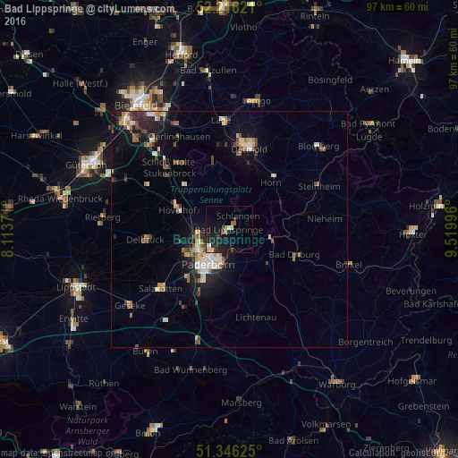
Analysis of Bad Lippspringe night lights 2016
Square area 10x10 km:
 0.14%
0.14%90-99
1.96%80-89
1.26%70-79
1.26%60-69
1.12%50-59
0.98%40-49
1.4%30-39
1.26%20-29
6.02%10-19
15.69%0-9
68.91%Square area 50x50 km:
0.57%90-99
0.9%80-89
0.64%70-79
0.67%60-69
0.81%50-59
0.78%40-49
0.87%30-39
0.63%20-29
1.66%10-19
4.31%0-9
88.15%Clear (daylight) street map image can be seen on geolist.org.
Map coordinates:
52° 12' 58.4" North, 8° 6' 49.4" East
51° 46' 60" North, 8° 49' 0.6" East
51° 20' 46.5" North, 9° 31' 11.9" East
Some cities around Bad Lippspringe sort by population:
• Paderborn
8.3 km =5.2 mi,  211°
211°
• Delbrück
17.6 km =10.9 mi,  263°
263°
• Bad Driburg
15 km =9.3 mi,  111°
111°
• Hövelhof
12.1 km =7.5 mi,  287°
287°
• Augustdorf
15.2 km =9.4 mi,  337°
337°
• Altenbeken
8.9 km =5.5 mi,  103°
103°
• Schlangen
3.6 km =2.2 mi,  34°
34°
• Horn
13.2 km =8.2 mi,  41°
41°
2953405 (p: 15,175)
Sources (retrieved 2019-11-25):
» Earth at Night: Flat Maps 2012, 2016