Bad Driburg night lights from space
Night Light of Bad Driburg (North Rhine-Westphalia) from space (Germany) Src. Average luminocity for 10x10km area is 1.4328% and for 50x50km: 3.6261%.
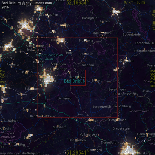
Analysis of Bad Driburg night lights 2016
Square area 10x10 km:
 0%
0%90-99
0%80-89
0%70-79
0%60-69
1.12%50-59
0.42%40-49
0.42%30-39
0%20-29
0%10-19
0.56%0-9
97.48%Square area 50x50 km:
0.46%90-99
0.62%80-89
0.48%70-79
0.38%60-69
0.48%50-59
0.46%40-49
0.46%30-39
0.4%20-29
0.9%10-19
2.64%0-9
92.72%Clear (daylight) street map image can be seen on geolist.org.
Map coordinates:
52° 9' 58.8" North, 8° 18' 59.7" East
51° 43' 58.7" North, 9° 1' 10.9" East
51° 17' 43.5" North, 9° 43' 22.2" East
Some cities around Bad Driburg sort by population:
• Brakel
11.6 km =7.2 mi,  98°
98°
• Bad Lippspringe
15 km =9.3 mi,  291°
291°
• Steinheim
16.1 km =10 mi,  17°
17°
• Lichtenau
15.4 km =9.6 mi,  213°
213°
• Altenbeken
6.4 km =4 mi,  303°
303°
• Schlangen
14.7 km =9.1 mi,  305°
305°
• Willebadessen
12 km =7.5 mi,  174°
174°
• Nieheim
10.3 km =6.4 mi,  38°
38°
2953525 (p: 19,553)
Sources (retrieved 2019-11-25):
» Earth at Night: Flat Maps 2012, 2016