Villapinzón night lights from space
Night Light of Villapinzón (Cundinamarca) from space (Colombia) Src. Average luminocity for 10x10km area is 2.6715% and for 50x50km: 1.5965%.
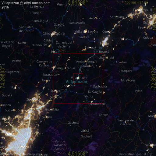
Analysis of Villapinzón night lights 2016
Square area 10x10 km:
 0.41%
0.41%90-99
0.41%80-89
0.62%70-79
0.21%60-69
0.83%50-59
0%40-49
0%30-39
0.62%20-29
0.21%10-19
0.83%0-9
95.87%Square area 50x50 km:
0.08%90-99
0.09%80-89
0.24%70-79
0.31%60-69
0.21%50-59
0.27%40-49
0.37%30-39
0.6%20-29
0.34%10-19
0.18%0-9
97.32%Clear (daylight) street map image can be seen on geolist.org.
Map coordinates:
5° 54' 57.5" North, 74° 17' 52.9" West
5° 12' 58.2" North, 73° 35' 41.6" West
4° 30' 56.1" North, 72° 53' 30.4" West
Some cities around Villapinzón sort by population:
• Tunja
43.5 km =27 mi,  35°
35°
• La Mesa
36.1 km =22.4 mi,  278°
278°
• Garagoa
29.6 km =18.4 mi,  120°
120°
• Chocontá
12.8 km =8 mi,  231°
231°
• Guateque
27 km =16.8 mi,  149°
149°
• Tocancipá
44.9 km =27.9 mi, 231°
• Nemocón
35.4 km =22 mi,  242°
242°
• Ramiriquí
35.3 km =21.9 mi,  54°
54°
3665924 (p: 5,874)
Sources (retrieved 2019-11-25):
» Earth at Night: Flat Maps 2012, 2016