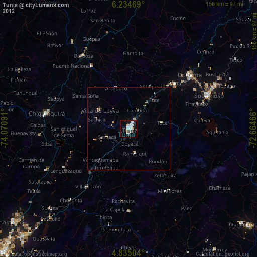
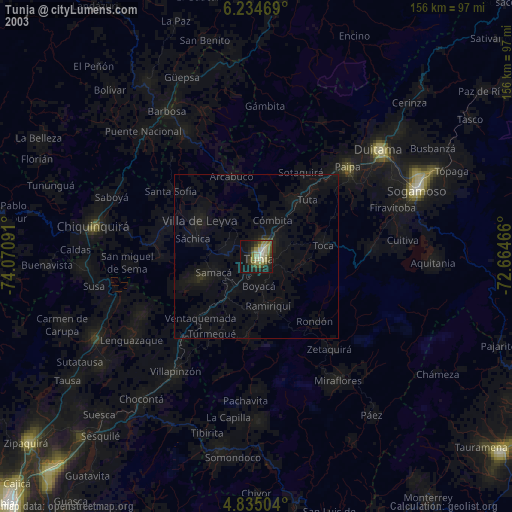
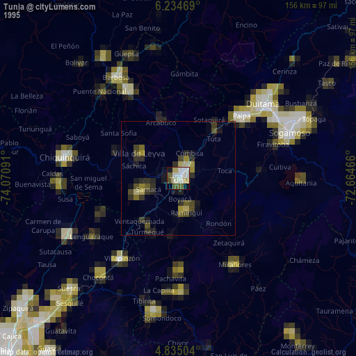
Tunja night lights from space
Night Light of Tunja (Boyacá) from space (Colombia) Src. Average luminocity for 10x10km area is 35.5351% and for 50x50km: 3.8731%.
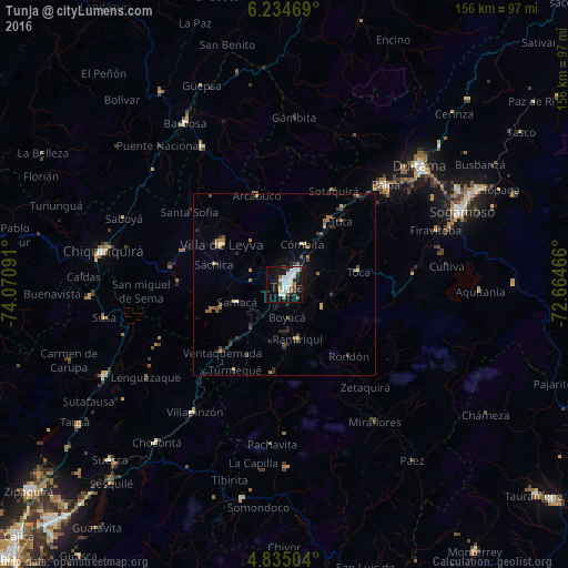
Analysis of Tunja night lights 2016
Square area 10x10 km:
 11.16%
90-99
8.88%80-89
1.24%70-79
0.62%60-69
2.27%50-59
4.75%40-49
3.1%30-39
3.1%20-29
4.13%10-19
35.74%0-9
25%Square area 50x50 km:
0.47%90-99
0.49%80-89
0.23%70-79
0.45%60-69
0.63%50-59
0.63%40-49
0.49%30-39
0.64%20-29
0.97%10-19
2.49%0-9
92.52%Clear (daylight) street map image can be seen on geolist.org.
Map coordinates:
6° 14' 4.9" North, 74° 4' 15.3" West
5° 32' 7" North, 73° 22' 4" West
4° 50' 6.1" North, 72° 39' 52.8" West
Some cities around Tunja sort by population:
• Duitama
49 km =30.4 mi,  48°
48°
• Paipa
38.9 km =24.2 mi, 45°
• Garagoa
50.4 km =31.3 mi,  179°
179°
• Moniquirá
44.2 km =27.5 mi,  329°
329°
• Villapinzón
43.5 km =27 mi,  215°
215°
• Pesca
35.2 km =21.9 mi,  87°
87°
• Villa de Leyva
20.5 km =12.7 mi,  302°
302°
• Ramiriquí
15.4 km =9.6 mi,  166°
166°
3666608 (p: 117,479)
Sources (retrieved 2019-11-25):
» NASA, Earths city lights 1995
» NASA city lights 2003
» Earth at Night: Flat Maps 2012, 2016