Guateque night lights from space
Night Light of Guateque (Boyacá) from space (Colombia) Src. Average luminocity for 10x10km area is 2.9091% and for 50x50km: 0.5636%.
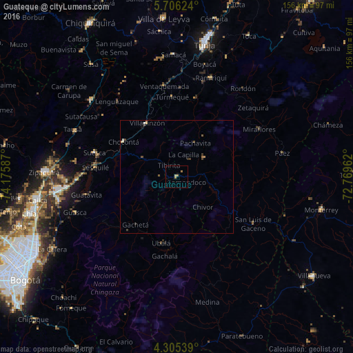
Analysis of Guateque night lights 2016
Square area 10x10 km:
 0%
0%90-99
0%80-89
0.83%70-79
0.83%60-69
1.65%50-59
0%40-49
0%30-39
0%20-29
0%10-19
0.62%0-9
96.07%Square area 50x50 km:
0.02%90-99
0.05%80-89
0.13%70-79
0.08%60-69
0.14%50-59
0.09%40-49
0.16%30-39
0.11%20-29
0.04%10-19
0.06%0-9
99.12%Clear (daylight) street map image can be seen on geolist.org.
Map coordinates:
5° 42' 22.5" North, 74° 10' 33.1" West
5° 0' 22.3" North, 73° 28' 21.9" West
4° 18' 19.4" North, 72° 46' 10.6" West
Some cities around Guateque sort by population:
• Villa de San Diego de Ubaté
50.8 km =31.6 mi,  311°
311°
• Garagoa
14.8 km =9.2 mi,  55°
55°
• Sopó
52.7 km =32.7 mi,  257°
257°
• Chocontá
28.2 km =17.5 mi,  303°
303°
• Tocancipá
49 km =30.4 mi, 264°
• Villapinzón
27 km =16.8 mi,  329°
329°
• Nemocón
45.4 km =28.2 mi,  278°
278°
• Ramiriquí
46.4 km =28.8 mi,  19°
19°
3681356 (p: 7,069)
Sources (retrieved 2019-11-25):
» Earth at Night: Flat Maps 2012, 2016