Soledad night lights from space
Night Light of Soledad (Atlántico) from space (Colombia) Src. Average luminocity for 10x10km area is 76.7532% and for 50x50km: 19.3578%.
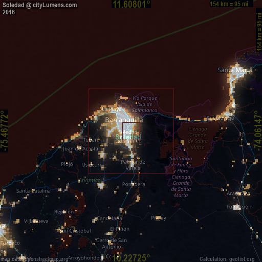
Analysis of Soledad night lights 2016
Square area 10x10 km:
 41.56%
90-99
13.85%80-89
2.16%70-79
3.9%60-69
5.41%50-59
8.23%40-49
12.12%30-39
6.71%20-29
5.19%10-19
0.87%0-9
0%Square area 50x50 km:
4.72%90-99
2.66%80-89
1.03%70-79
3.13%60-69
2.87%50-59
2.05%40-49
2.95%30-39
3.57%20-29
4.5%10-19
9.91%0-9
62.63%Clear (daylight) street map image can be seen on geolist.org.
Map coordinates:
11° 36' 28.8" North, 75° 28' 3.8" West
10° 55' 6.3" North, 74° 45' 52.5" West
10° 13' 38.1" North, 74° 3' 41.3" West
Some cities around Soledad sort by population:
• Barranquilla
5.9 km =3.7 mi,  341°
341°
• Malambo
6.6 km =4.1 mi,  188°
188°
• Palmar de Varela
19.8 km =12.3 mi,  176°
176°
• Santo Tomás
17.9 km =11.1 mi, 176°
• Sabanagrande
14.2 km =8.8 mi, 178°
• Galapa
13.5 km =8.4 mi,  259°
259°
• Sitionuevo
16.4 km =10.2 mi,  162°
162°
• Polonuevo
18.5 km =11.5 mi,  211°
211°
3667849 (p: 342,556)
Sources (retrieved 2019-11-25):
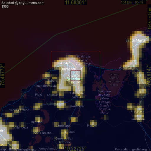
» NASA, Earths city lights 1995
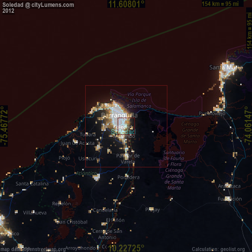
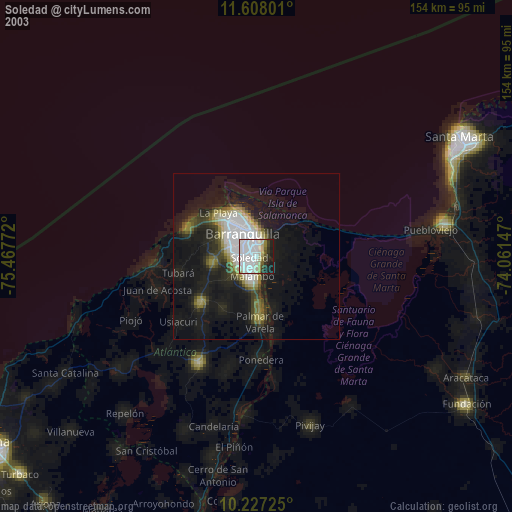
» NASA city lights 2003
» Earth at Night: Flat Maps 2012, 2016