Malambo night lights from space
Night Light of Malambo (Atlántico) from space (Colombia) Src. Average luminocity for 10x10km area is 55.9091% and for 50x50km: 19.5073%.
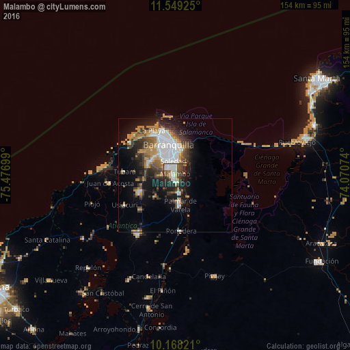
Analysis of Malambo night lights 2016
Square area 10x10 km:
 15.15%
90-99
11.69%80-89
4.98%70-79
5.19%60-69
3.9%50-59
7.79%40-49
11.9%30-39
9.52%20-29
19.48%10-19
10.39%0-9
0%Square area 50x50 km:
4.77%90-99
2.71%80-89
1.06%70-79
2.93%60-69
2.95%50-59
2.05%40-49
3.05%30-39
3.59%20-29
4.58%10-19
9.73%0-9
62.58%Clear (daylight) street map image can be seen on geolist.org.
Map coordinates:
11° 32' 57.3" North, 75° 28' 37.2" West
10° 51' 34.3" North, 74° 46' 25.9" West
10° 10' 5.6" North, 74° 4' 14.7" West
Some cities around Malambo sort by population:
• Barranquilla
12.1 km =7.5 mi,  356°
356°
• Soledad
6.6 km =4.1 mi,  8°
8°
• Palmar de Varela
13.4 km =8.3 mi,  170°
170°
• Santo Tomás
11.5 km =7.1 mi, 169°
• Sabanagrande
7.7 km =4.8 mi, 169°
• Galapa
12.9 km =8 mi,  288°
288°
• Sitionuevo
10.8 km =6.7 mi,  147°
147°
• Polonuevo
12.6 km =7.8 mi,  223°
223°
3675595 (p: 101,534)
Sources (retrieved 2019-11-25):
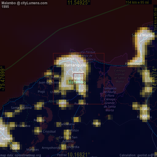
» NASA, Earths city lights 1995
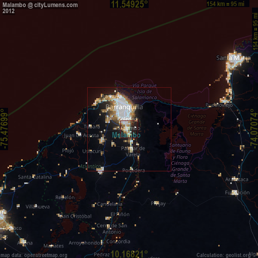
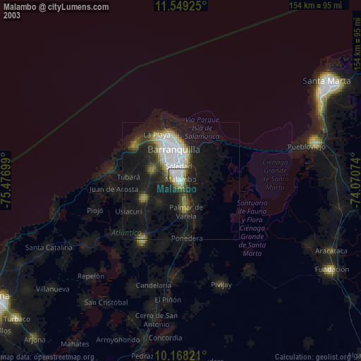
» NASA city lights 2003
» Earth at Night: Flat Maps 2012, 2016