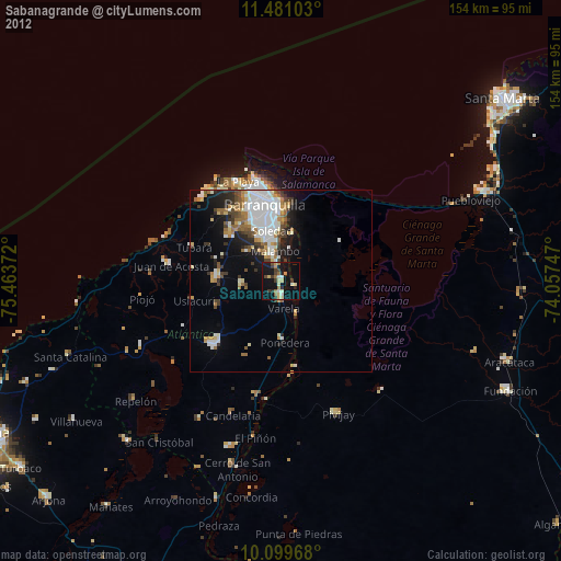
Sabanagrande night lights from space
Night Light of Sabanagrande (Atlántico) from space (Colombia) Src. Average luminocity for 10x10km area is 29.3967% and for 50x50km: 16.7651%.
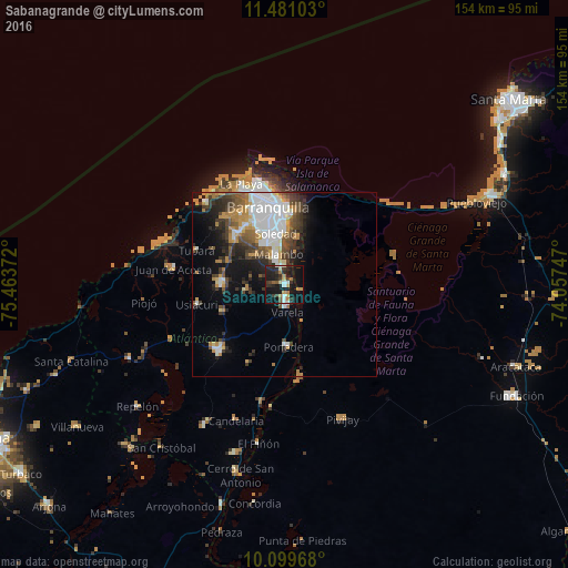
Analysis of Sabanagrande night lights 2016
Square area 10x10 km:
 4.34%
4.34%90-99
1.86%80-89
3.72%70-79
2.48%60-69
5.79%50-59
1.65%40-49
1.86%30-39
9.92%20-29
12.19%10-19
39.88%0-9
16.32%Square area 50x50 km:
4.37%90-99
2.33%80-89
0.93%70-79
2.35%60-69
2.31%50-59
1.79%40-49
2.69%30-39
3.2%20-29
3.64%10-19
7.45%0-9
68.94%Clear (daylight) street map image can be seen on geolist.org.
Map coordinates:
11° 28' 51.7" North, 75° 27' 49.4" West
10° 47' 28.1" North, 74° 45' 38.1" West
10° 5' 58.8" North, 74° 3' 26.9" West
Some cities around Sabanagrande sort by population:
• Soledad
14.2 km =8.8 mi,  358°
358°
• Malambo
7.7 km =4.8 mi,  349°
349°
• Palmar de Varela
5.7 km =3.5 mi,  173°
173°
• Santo Tomás
3.8 km =2.4 mi, 169°
• Sitionuevo
4.6 km =2.9 mi,  109°
109°
• Polonuevo
10.3 km =6.4 mi,  261°
261°
• Ponedera
16.5 km =10.3 mi,  177°
177°
• Remolino
11 km =6.8 mi,  153°
153°
3670513 (p: 24,880)
Sources (retrieved 2019-11-25):
» Earth at Night: Flat Maps 2012, 2016