Ponedera night lights from space
Night Light of Ponedera (Atlántico) from space (Colombia) Src. Average luminocity for 10x10km area is 4.2769% and for 50x50km: 6.2685%.
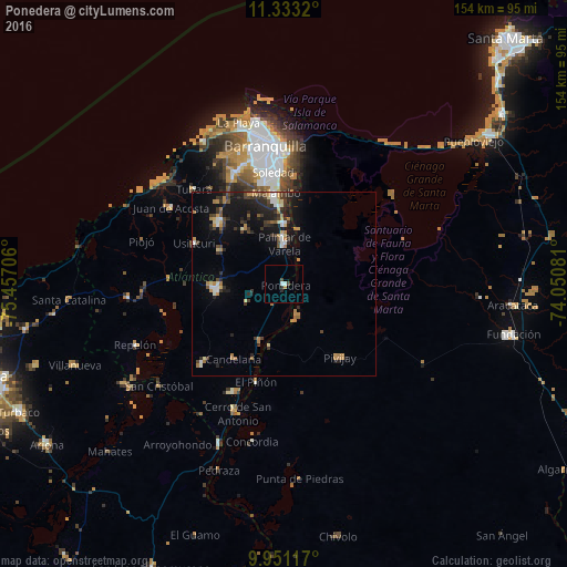
Analysis of Ponedera night lights 2016
Square area 10x10 km:
 1.24%
1.24%90-99
0.41%80-89
0%70-79
0.83%60-69
0%50-59
0%40-49
1.65%30-39
0%20-29
1.65%10-19
0%0-9
94.21%Square area 50x50 km:
0.56%90-99
0.61%80-89
0.51%70-79
0.94%60-69
1.14%50-59
0.44%40-49
0.96%30-39
1.57%20-29
1.98%10-19
5.11%0-9
86.2%Clear (daylight) street map image can be seen on geolist.org.
Map coordinates:
11° 19' 59.5" North, 75° 27' 25.4" West
10° 38' 34.7" North, 74° 45' 14.1" West
9° 57' 4.2" North, 74° 3' 2.9" West
Some cities around Ponedera sort by population:
• Sabanalarga
18.4 km =11.4 mi,  265°
265°
• Palmar de Varela
10.9 km =6.8 mi,  359°
359°
• Santo Tomás
12.8 km =8 mi, 359°
• Sabanagrande
16.5 km =10.3 mi, 357°
• Sitionuevo
15.4 km =9.6 mi,  13°
13°
• Polonuevo
18.4 km =11.4 mi,  323°
323°
• Remolino
7.8 km =4.8 mi,  32°
32°
• Salamina
17.6 km =10.9 mi,  194°
194°
3671936 (p: 11,221)
Sources (retrieved 2019-11-25):
» Earth at Night: Flat Maps 2012, 2016