Lejanías night lights from space
Night Light of Lejanías (Meta) from space (Colombia) Src. Average luminocity for 10x10km area is 1.1602% and for 50x50km: 0.2862%.
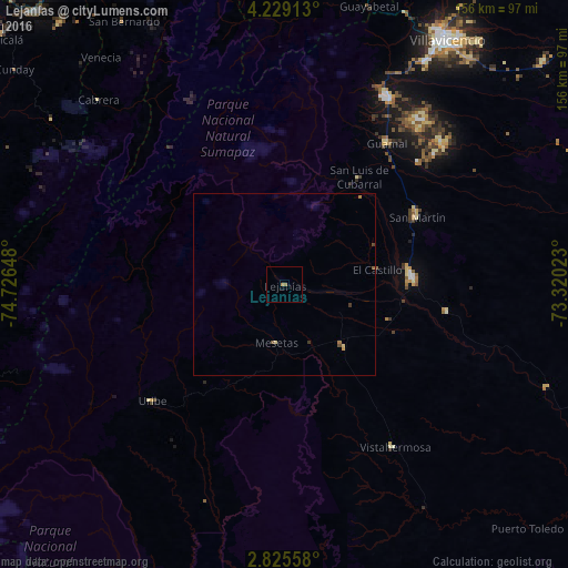
Analysis of Lejanías night lights 2016
Square area 10x10 km:
 0%
0%90-99
0%80-89
0%70-79
0%60-69
1.73%50-59
0%40-49
0%30-39
0%20-29
0%10-19
0%0-9
98.27%Square area 50x50 km:
0%90-99
0%80-89
0.07%70-79
0.03%60-69
0.14%50-59
0.06%40-49
0.08%30-39
0.07%20-29
0%10-19
0%0-9
99.55%Clear (daylight) street map image can be seen on geolist.org.
Map coordinates:
4° 13' 44.9" North, 74° 43' 35.3" West
3° 31' 39.4" North, 74° 1' 24.1" West
2° 49' 32.1" North, 73° 19' 12.8" West
Some cities around Lejanías sort by population:
• Villavicencio
81.3 km =50.5 mi,  32°
32°
• Acacías
59 km =36.7 mi, 29°
• Granada
35.2 km =21.9 mi,  86°
86°
• San Martín
40.5 km =25.2 mi,  62°
62°
• Restrepo
96.1 km =59.7 mi, 32°
• Arbeláez
93.5 km =58.1 mi,  332°
332°
• Puerto Lleras
88.8 km =55.2 mi,  129°
129°
• Guamal
48.5 km =30.1 mi,  36°
36°
3732964 (p: 5,157)
Sources (retrieved 2019-11-25):
» Earth at Night: Flat Maps 2012, 2016