San Martín night lights from space
Night Light of San Martín (Meta) from space (Colombia) Src. Average luminocity for 10x10km area is 8.2857% and for 50x50km: 4.073%.
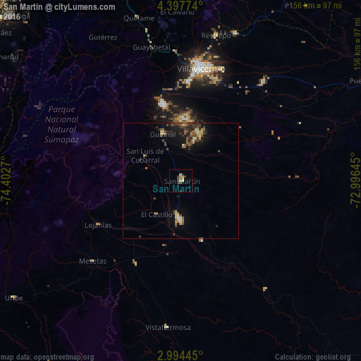
Analysis of San Martín night lights 2016
Square area 10x10 km:
 0%
0%90-99
0%80-89
3.03%70-79
1.95%60-69
0.22%50-59
0.87%40-49
1.3%30-39
3.9%20-29
1.3%10-19
0.87%0-9
86.58%Square area 50x50 km:
0.15%90-99
0.22%80-89
0.68%70-79
0.54%60-69
0.49%50-59
0.77%40-49
0.81%30-39
1.32%20-29
1.03%10-19
2.4%0-9
91.59%Clear (daylight) street map image can be seen on geolist.org.
Map coordinates:
4° 23' 51.9" North, 74° 24' 9.7" West
3° 41' 46.9" North, 73° 41' 58.5" West
2° 59' 40" North, 72° 59' 47.2" West
Some cities around San Martín sort by population:
• Villavicencio
50.2 km =31.2 mi,  9°
9°
• Acacías
33 km =20.5 mi,  348°
348°
• Granada
16.7 km =10.4 mi,  182°
182°
• Cumaral
68.1 km =42.3 mi,  20°
20°
• Restrepo
64.3 km =40 mi, 13°
• Lejanías
40.5 km =25.2 mi,  242°
242°
• Puerto Lleras
81.8 km =50.8 mi,  156°
156°
• Guamal
21.7 km =13.5 mi,  340°
340°
3669332 (p: 16,273)
Sources (retrieved 2019-11-25):
» Earth at Night: Flat Maps 2012, 2016