Guamal night lights from space
Night Light of Guamal (Meta) from space (Colombia) Src. Average luminocity for 10x10km area is 14.013% and for 50x50km: 7.9615%.
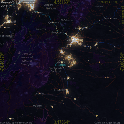
Analysis of Guamal night lights 2016
Square area 10x10 km:
 0%
0%90-99
0%80-89
2.38%70-79
1.08%60-69
0.43%50-59
3.46%40-49
4.33%30-39
4.76%20-29
3.25%10-19
15.8%0-9
64.5%Square area 50x50 km:
0.39%90-99
0.56%80-89
1.15%70-79
0.82%60-69
0.97%50-59
1.7%40-49
1.82%30-39
2.37%20-29
2.12%10-19
7.11%0-9
81.01%Clear (daylight) street map image can be seen on geolist.org.
Map coordinates:
4° 34' 53.9" North, 74° 28' 7.6" West
3° 52' 49.5" North, 73° 45' 56.4" West
3° 10' 43.1" North, 73° 3' 45.1" West
Some cities around Guamal sort by population:
• Villavicencio
32.9 km =20.4 mi,  27°
27°
• Acacías
11.9 km =7.4 mi,  4°
4°
• Granada
37.7 km =23.4 mi,  170°
170°
• San Martín
21.7 km =13.5 mi,  160°
160°
• Cumaral
53.3 km =33.1 mi,  35°
35°
• Cáqueza
61.8 km =38.4 mi,  341°
341°
• Restrepo
47.7 km =29.6 mi, 28°
• Lejanías
48.5 km =30.1 mi,  216°
216°
3681605 (p: 5,026)
Sources (retrieved 2019-11-25):
» Earth at Night: Flat Maps 2012, 2016