Arbeláez night lights from space
Night Light of Arbeláez (Cundinamarca) from space (Colombia) Src. Average luminocity for 10x10km area is 10.9416% and for 50x50km: 4.4382%.
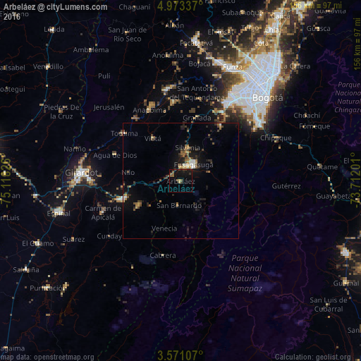
Analysis of Arbeláez night lights 2016
Square area 10x10 km:
 0%
0%90-99
0%80-89
1.08%70-79
0.65%60-69
0.87%50-59
5.41%40-49
1.73%30-39
1.95%20-29
1.3%10-19
15.8%0-9
71.21%Square area 50x50 km:
0.22%90-99
0.39%80-89
0.39%70-79
0.39%60-69
0.69%50-59
0.93%40-49
0.88%30-39
0.87%20-29
1.04%10-19
4.1%0-9
90.1%Clear (daylight) street map image can be seen on geolist.org.
Map coordinates:
4° 58' 24.1" North, 75° 7' 5.7" West
4° 16' 21.1" North, 74° 24' 54.5" West
3° 34' 15.9" North, 73° 42' 43.2" West
Some cities around Arbeláez sort by population:
• Fusagasugá
9.1 km =5.7 mi,  38°
38°
• Melgar
26.1 km =16.2 mi,  253°
253°
• Sibaté
29.8 km =18.5 mi, 35°
• Agua de Dios
30.5 km =19 mi,  292°
292°
• Tocaima
31.9 km =19.8 mi,  310°
310°
• Silvania
14.9 km =9.3 mi,  12°
12°
• Viotá
21.8 km =13.5 mi,  327°
327°
• Carmen de Apicalá
36.6 km =22.7 mi, 247°
3689709 (p: 5,252)
Sources (retrieved 2019-11-25):
» Earth at Night: Flat Maps 2012, 2016