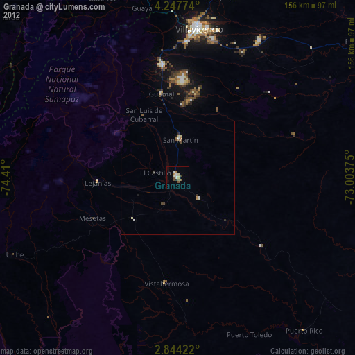
Granada night lights from space
Night Light of Granada (Meta) from space (Colombia) Src. Average luminocity for 10x10km area is 19.2662% and for 50x50km: 1.6071%.
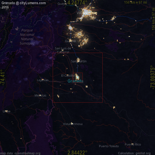
Analysis of Granada night lights 2016
Square area 10x10 km:
 2.6%
2.6%90-99
2.16%80-89
3.03%70-79
3.68%60-69
3.03%50-59
3.46%40-49
1.08%30-39
1.73%20-29
0%10-19
3.46%0-9
75.76%Square area 50x50 km:
0.1%90-99
0.12%80-89
0.31%70-79
0.28%60-69
0.29%50-59
0.24%40-49
0.21%30-39
0.31%20-29
0.1%10-19
0.21%0-9
97.82%Clear (daylight) street map image can be seen on geolist.org.
Map coordinates:
4° 14' 51.9" North, 74° 24' 36" West
3° 32' 46.5" North, 73° 42' 24.7" West
2° 50' 39.2" North, 73° 0' 13.5" West
Some cities around Granada sort by population:
• Villavicencio
66.8 km =41.5 mi,  7°
7°
• Acacías
49.3 km =30.6 mi,  353°
353°
• San Martín
16.7 km =10.4 mi,  2°
2°
• Cumaral
84.2 km =52.3 mi,  16°
16°
• Restrepo
80.8 km =50.2 mi, 11°
• Lejanías
35.2 km =21.9 mi,  266°
266°
• Puerto Lleras
67.2 km =41.8 mi,  150°
150°
• Guamal
37.7 km =23.4 mi, 350°
3681957 (p: 32,365)
Sources (retrieved 2019-11-25):
» Earth at Night: Flat Maps 2012, 2016