Guapí night lights from space
Night Light of Guapí (Cauca) from space (Colombia) Src. Average luminocity for 10x10km area is 0.3528% and for 50x50km: 0.9026%.
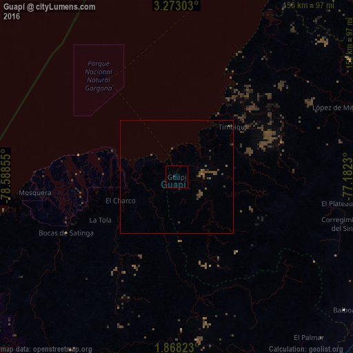
Analysis of Guapí night lights 2016
Square area 10x10 km:
 0%
0%90-99
0%80-89
0%70-79
0%60-69
0%50-59
0%40-49
0%30-39
0.87%20-29
0%10-19
0%0-9
99.13%Square area 50x50 km:
0%90-99
0%80-89
0%70-79
0%60-69
0.09%50-59
0.47%40-49
0.58%30-39
0.37%20-29
0.1%10-19
0.14%0-9
98.25%Clear (daylight) street map image can be seen on geolist.org.
Map coordinates:
3° 16' 22.9" North, 78° 35' 18.8" West
2° 34' 15" North, 77° 53' 7.5" West
1° 52' 5.6" North, 77° 10' 56.3" West
Some cities around Guapí sort by population:
• El Charco
26.9 km =16.7 mi,  247°
247°
• Patía
108 km =67.1 mi,  121°
121°
• El Bordo
112.3 km =69.8 mi, 116°
• Villa Rica
115.3 km =71.6 mi,  93°
93°
• Barbacoas
103.9 km =64.6 mi,  195°
195°
• Balboa
94.8 km =58.9 mi,  128°
128°
• Timbiquí
33.1 km =20.6 mi,  47°
47°
• Salahonda
104.2 km =64.7 mi,  235°
235°
3681505 (p: 13,853)
Sources (retrieved 2019-11-25):
» Earth at Night: Flat Maps 2012, 2016