Barbacoas night lights from space
Night Light of Barbacoas (Nariño) from space (Colombia) Src. Average luminocity for 10x10km area is 0% and for 50x50km: 0.2744%.
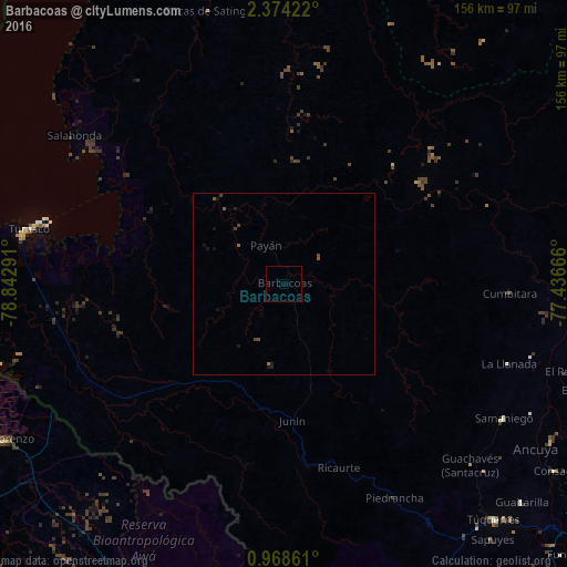
Analysis of Barbacoas night lights 2016
Square area 10x10 km:
 0%
0%90-99
0%80-89
0%70-79
0%60-69
0%50-59
0%40-49
0%30-39
0%20-29
0%10-19
0%0-9
100%Square area 50x50 km:
0%90-99
0%80-89
0%70-79
0%60-69
0.03%50-59
0.14%40-49
0.15%30-39
0.06%20-29
0.07%10-19
0.31%0-9
99.24%Clear (daylight) street map image can be seen on geolist.org.
Map coordinates:
2° 22' 27.2" North, 78° 50' 34.5" West
1° 40' 17.5" North, 78° 8' 23.2" West
0° 58' 7" North, 77° 26' 12" West
Some cities around Barbacoas sort by population:
• Tumaco
73.8 km =45.9 mi,  280°
280°
• Túquerres
87.1 km =54.1 mi,  138°
138°
• Samaniego
70.9 km =44.1 mi,  121°
121°
• Sandoná
86 km =53.4 mi, 119°
• Olaya Herrera
86.1 km =53.5 mi, 123°
• El Tambo
88.1 km =54.7 mi,  109°
109°
• Salahonda
70.8 km =44 mi,  305°
305°
• Ancuya
83.1 km =51.6 mi, 123°
3689228 (p: 7,633)
Sources (retrieved 2019-11-25):
» Earth at Night: Flat Maps 2012, 2016