Fundación night lights from space
Night Light of Fundación (Magdalena) from space (Colombia) Src. Average luminocity for 10x10km area is 15.905% and for 50x50km: 1.9825%.
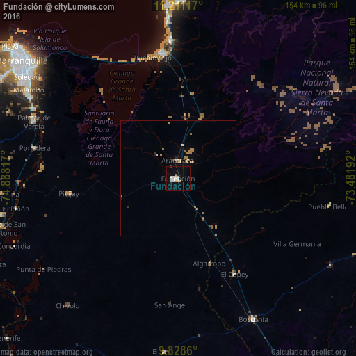
Analysis of Fundación night lights 2016
Square area 10x10 km:
 4.34%
4.34%90-99
3.93%80-89
1.65%70-79
1.45%60-69
0.21%50-59
0%40-49
0.41%30-39
0%20-29
0%10-19
4.13%0-9
83.88%Square area 50x50 km:
0.24%90-99
0.21%80-89
0.08%70-79
0.35%60-69
0.74%50-59
0.15%40-49
0.03%30-39
0.13%20-29
0.08%10-19
0.22%0-9
97.75%Clear (daylight) street map image can be seen on geolist.org.
Map coordinates:
11° 12' 40.2" North, 74° 53' 17.4" West
10° 31' 14.4" North, 74° 11' 6.1" West
9° 49' 43" North, 73° 28' 54.9" West
Some cities around Fundación sort by population:
• Ciénaga
54.5 km =33.9 mi,  352°
352°
• Pivijay
47.6 km =29.6 mi,  262°
262°
• Aracataca
7.9 km =4.9 mi,  356°
356°
• Ariguaní
36.3 km =22.6 mi,  146°
146°
• El Copey
47.9 km =29.8 mi, 149°
• El Retén
13.6 km =8.5 mi,  317°
317°
• Puebloviejo
53.7 km =33.4 mi, 348°
• Algarrobo
56.6 km =35.2 mi,  228°
228°
3682292 (p: 59,175)
Sources (retrieved 2019-11-25):
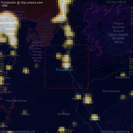
» NASA, Earths city lights 1995
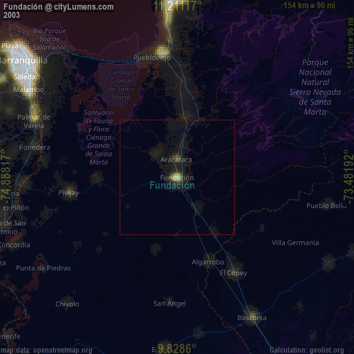
» NASA city lights 2003
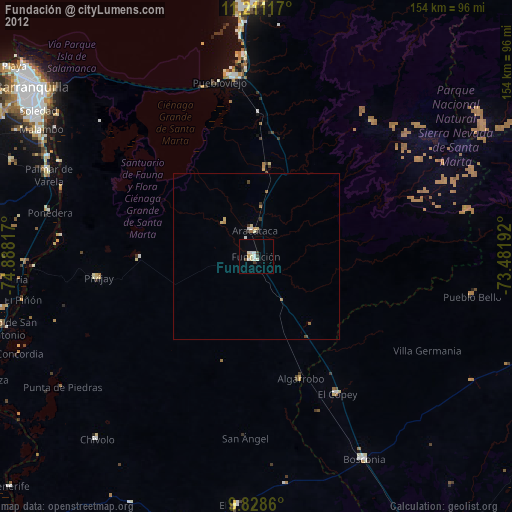
» Earth at Night: Flat Maps 2012, 2016