Ciénaga night lights from space
Night Light of Ciénaga (Magdalena) from space (Colombia) Src. Average luminocity for 10x10km area is 40.5087% and for 50x50km: 7.2483%.
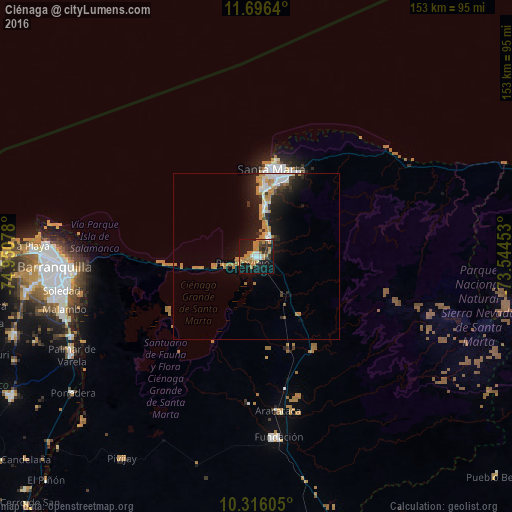
Analysis of Ciénaga night lights 2016
Square area 10x10 km:
 5.19%
5.19%90-99
3.46%80-89
2.6%70-79
9.31%60-69
17.53%50-59
0%40-49
1.52%30-39
7.79%20-29
8.01%10-19
39.18%0-9
5.41%Square area 50x50 km:
0.94%90-99
1%80-89
0.33%70-79
1.36%60-69
2.31%50-59
0.13%40-49
0.28%30-39
0.93%20-29
1.98%10-19
6.76%0-9
83.98%Clear (daylight) street map image can be seen on geolist.org.
Map coordinates:
11° 41' 47" North, 74° 57' 2.8" West
11° 0' 25.3" North, 74° 14' 51.5" West
10° 18' 57.8" North, 73° 32' 40.3" West
Some cities around Ciénaga sort by population:
• Barranquilla
58.4 km =36.3 mi,  265°
265°
• Santa Marta
26.5 km =16.5 mi,  11°
11°
• Soledad
57.3 km =35.6 mi,  260°
260°
• Fundación
54.5 km =33.9 mi,  172°
172°
• Aracataca
46.6 km =29 mi, 172°
• El Retén
44.1 km =27.4 mi,  182°
182°
• Puebloviejo
4.3 km =2.7 mi,  249°
249°
• Sitionuevo
57.6 km =35.8 mi,  243°
243°
3686279 (p: 88,311)
Sources (retrieved 2019-11-25):
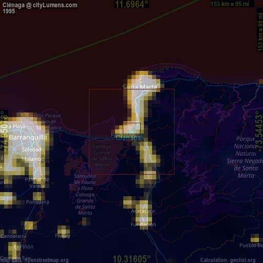
» NASA, Earths city lights 1995
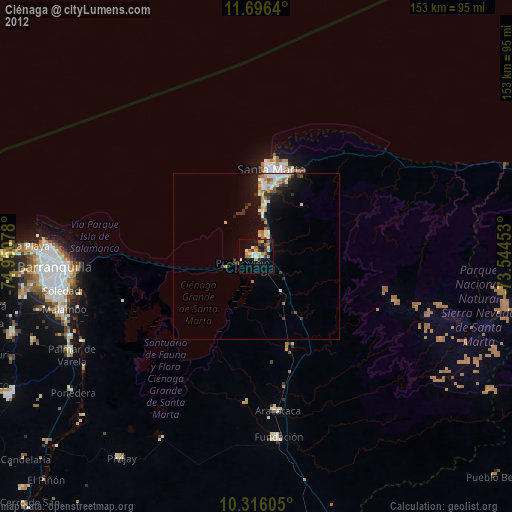
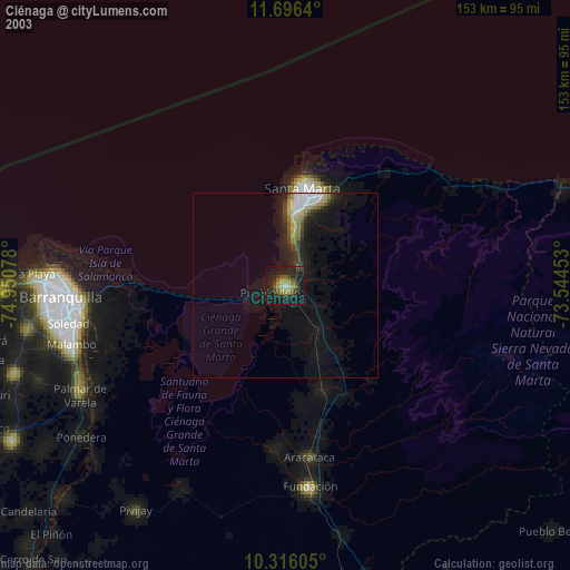
» NASA city lights 2003
» Earth at Night: Flat Maps 2012, 2016