Fómeque night lights from space
Night Light of Fómeque (Cundinamarca) from space (Colombia) Src. Average luminocity for 10x10km area is 2.0661% and for 50x50km: 10.0457%.
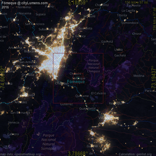
Analysis of Fómeque night lights 2016
Square area 10x10 km:
 0%
0%90-99
0%80-89
0.41%70-79
0.41%60-69
1.65%50-59
0%40-49
0.41%30-39
0%20-29
0%10-19
0%0-9
97.11%Square area 50x50 km:
5.2%90-99
1.49%80-89
0.27%70-79
0.51%60-69
0.63%50-59
1.18%40-49
0.88%30-39
0.99%20-29
1.35%10-19
2.71%0-9
84.78%Clear (daylight) street map image can be seen on geolist.org.
Map coordinates:
5° 11' 18.9" North, 74° 36' 2.2" West
4° 29' 16.7" North, 73° 53' 51" West
3° 47' 12" North, 73° 11' 39.7" West
Some cities around Fómeque sort by population:
• Bogotá
24.5 km =15.2 mi,  303°
303°
• Soacha
36.8 km =22.9 mi,  286°
286°
• Funza
43.1 km =26.8 mi,  306°
306°
• Mosquera
44.1 km =27.4 mi, 303°
• Sibaté
40.1 km =24.9 mi,  270°
270°
• La Calera
27.1 km =16.8 mi,  342°
342°
• Cáqueza
10.7 km =6.6 mi,  210°
210°
• Cota
42.1 km =26.2 mi,  328°
328°
3682380 (p: 5,389)
Sources (retrieved 2019-11-25):
» Earth at Night: Flat Maps 2012, 2016