Bogotá night lights from space
Night Light of Bogotá (Bogota D.C.) from space (Colombia) Src. Average luminocity for 10x10km area is 84.531% and for 50x50km: 33.3707%.
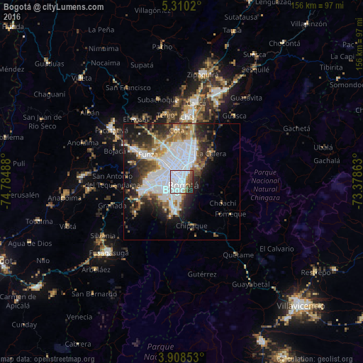
Analysis of Bogotá night lights 2016
Square area 10x10 km:
 60.33%
90-99
10.33%80-89
1.24%70-79
2.27%60-69
3.1%50-59
7.85%40-49
4.55%30-39
4.55%20-29
5.17%10-19
0.62%0-9
0%Square area 50x50 km:
13.18%90-99
5.26%80-89
2%70-79
2.94%60-69
3.22%50-59
3.92%40-49
4.01%30-39
4.53%20-29
6.91%10-19
9.63%0-9
44.42%Clear (daylight) street map image can be seen on geolist.org.
Map coordinates:
5° 18' 36.7" North, 74° 47' 5.6" West
4° 36' 35" North, 74° 4' 54.3" West
3° 54' 30.7" North, 73° 22' 43.1" West
Some cities around Bogotá sort by population:
• Soacha
15.3 km =9.5 mi,  257°
257°
• Funza
18.7 km =11.6 mi,  309°
309°
• Madrid
24.4 km =15.2 mi,  304°
304°
• Mosquera
19.6 km =12.2 mi, 303°
• Sibaté
23.7 km =14.7 mi,  236°
236°
• La Calera
17.5 km =10.9 mi,  45°
45°
• Cota
22.3 km =13.9 mi,  355°
355°
• Fómeque
24.5 km =15.2 mi,  123°
123°
3688689 (p: 7,674,366)
Sources (retrieved 2019-11-25):
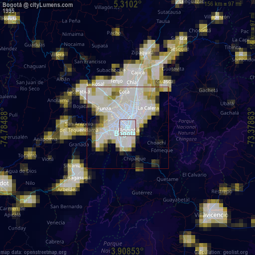
» NASA, Earths city lights 1995
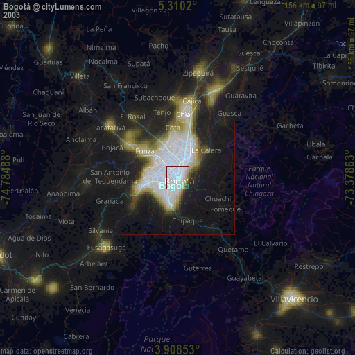
» NASA city lights 2003
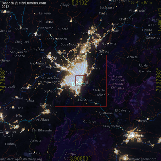
» Earth at Night: Flat Maps 2012, 2016