Cota night lights from space
Night Light of Cota (Cundinamarca) from space (Colombia) Src. Average luminocity for 10x10km area is 59.6467% and for 50x50km: 36.6465%.
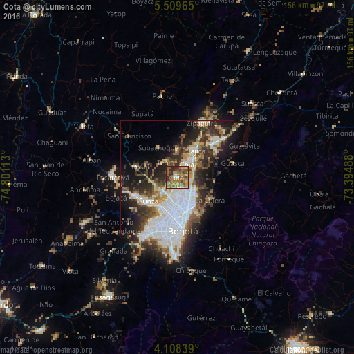
Analysis of Cota night lights 2016
Square area 10x10 km:
 3.93%
3.93%90-99
6.2%80-89
5.17%70-79
14.88%60-69
21.9%50-59
18.6%40-49
9.5%30-39
11.16%20-29
8.06%10-19
0.62%0-9
0%Square area 50x50 km:
12.16%90-99
5.16%80-89
2.53%70-79
3.78%60-69
4.03%50-59
5.26%40-49
5.32%30-39
6.13%20-29
8.74%10-19
12.52%0-9
34.38%Clear (daylight) street map image can be seen on geolist.org.
Map coordinates:
5° 30' 34.7" North, 74° 48' 4.1" West
4° 48' 33.8" North, 74° 5' 52.8" West
4° 6' 30.2" North, 73° 23' 41.6" West
Some cities around Cota sort by population:
• Chía
7 km =4.3 mi,  38°
38°
• Funza
16.3 km =10.1 mi,  230°
230°
• Madrid
20.3 km =12.6 mi,  245°
245°
• Mosquera
18.6 km =11.6 mi, 231°
• Cajicá
14.4 km =8.9 mi,  32°
32°
• La Calera
17.3 km =10.7 mi,  124°
124°
• Sopó
20.8 km =12.9 mi,  58°
58°
• El Rosal
18.6 km =11.6 mi,  285°
285°
3685733 (p: 7,615)
Sources (retrieved 2019-11-25):
» Earth at Night: Flat Maps 2012, 2016