Weihai night lights from space
Night Light of Weihai (Shandong) from space (China) Src. Average luminocity for 10x10km area is 68.4627% and for 50x50km: 16.4641%.
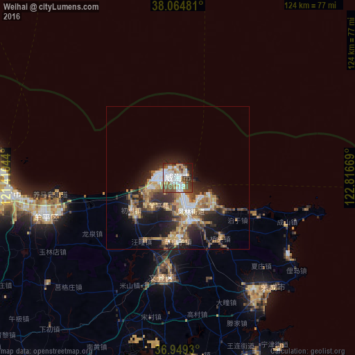
Analysis of Weihai night lights 2016
Square area 10x10 km:
 19.97%
90-99
18.02%80-89
6.33%70-79
6.17%60-69
6.66%50-59
14.94%40-49
9.9%30-39
6.01%20-29
6.17%10-19
5.68%0-9
0.16%Square area 50x50 km:
2.2%90-99
2.52%80-89
2.31%70-79
2.39%60-69
2.49%50-59
2.95%40-49
2.14%30-39
3%20-29
4.72%10-19
8.24%0-9
67.04%Clear (daylight) street map image can be seen on geolist.org.
Map coordinates:
38° 3' 53.3" North, 121° 24' 37.6" East
37° 30' 32.9" North, 122° 6' 48.8" East
36° 56' 57.5" North, 122° 49' 0.1" East
Some cities around Weihai sort by population:
• Yantai
59.5 km =37 mi,  266°
266°
• Tianfu
27.8 km =17.3 mi,  191°
191°
• Dongcun
117.4 km =72.9 mi,  226°
226°
• Yatou
48.6 km =30.2 mi,  143°
143°
• Dengzhou
123.8 km =76.9 mi,  285°
285°
• Zhuangyuan
115.8 km =72 mi,  258°
258°
• Qingyang
75.5 km =46.9 mi, 268°
• Ninghai
46.7 km =29 mi,  252°
252°
1791673 (p: 152,595)
Sources (retrieved 2019-11-25):
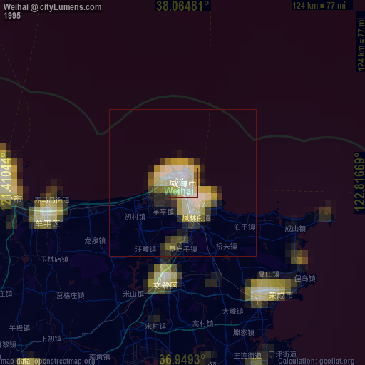
» NASA, Earths city lights 1995
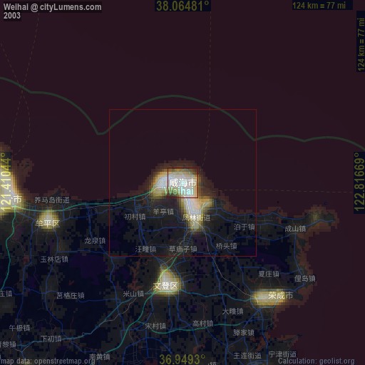
» NASA city lights 2003
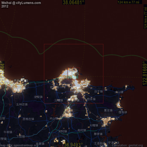
» Earth at Night: Flat Maps 2012, 2016