Qingyang night lights from space
Night Light of Qingyang (Shandong) from space (China) Src. Average luminocity for 10x10km area is 71.8653% and for 50x50km: 24.9263%.
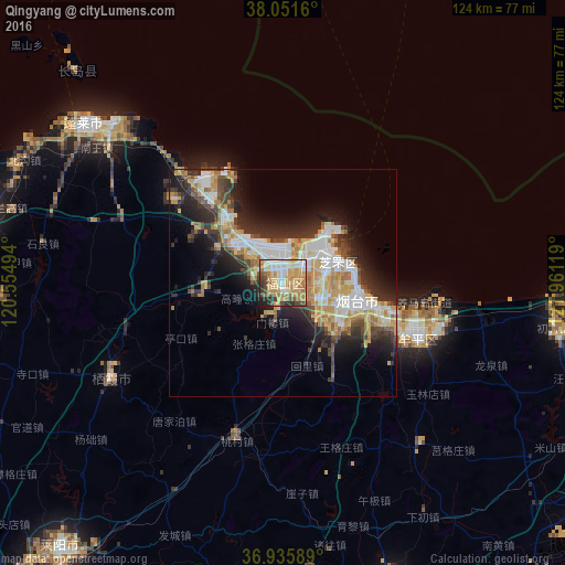
Analysis of Qingyang night lights 2016
Square area 10x10 km:
 12.34%
90-99
14.12%80-89
15.26%70-79
20.78%60-69
12.01%50-59
6.17%40-49
7.63%30-39
4.71%20-29
5.03%10-19
1.95%0-9
0%Square area 50x50 km:
4.83%90-99
4.62%80-89
3.83%70-79
4.19%60-69
3.2%50-59
2.04%40-49
2.81%30-39
4.09%20-29
6.54%10-19
8.77%0-9
55.08%Clear (daylight) street map image can be seen on geolist.org.
Map coordinates:
38° 3' 5.8" North, 120° 33' 17.8" East
37° 29' 45" North, 121° 15' 29" East
36° 56' 9.2" North, 121° 57' 40.3" East
Some cities around Qingyang sort by population:
• Yantai
16.3 km =10.1 mi,  97°
97°
• Laiyang
75.3 km =46.8 mi,  219°
219°
• Weihai
75.5 km =46.9 mi,  88°
88°
• Zhaoyuan
76.3 km =47.4 mi,  259°
259°
• Tianfu
74.8 km =46.5 mi,  110°
110°
• Dengzhou
56 km =34.8 mi,  308°
308°
• Zhuangyuan
43.5 km =27 mi,  240°
240°
• Ninghai
33.3 km =20.7 mi, 111°
1810920 (p: 65,622)
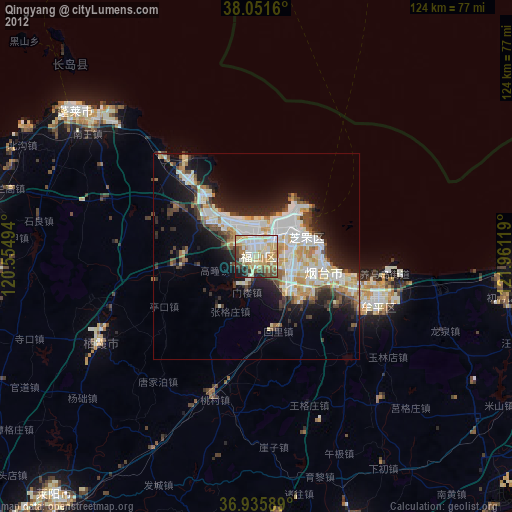
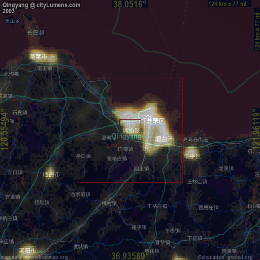
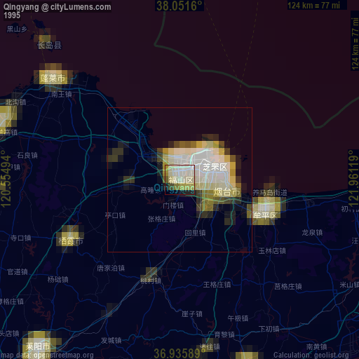
Sources (retrieved 2019-11-25):
» NASA, Earths city lights 1995
» NASA city lights 2003
» Earth at Night: Flat Maps 2012, 2016