Tianfu night lights from space
Night Light of Tianfu (Shandong) from space (China) Src. Average luminocity for 10x10km area is 22.648% and for 50x50km: 14.6788%.
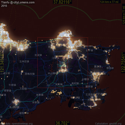
Analysis of Tianfu night lights 2016
Square area 10x10 km:
 0%
0%90-99
0%80-89
2.04%70-79
1.36%60-69
6.46%50-59
3.57%40-49
5.27%30-39
6.8%20-29
10.37%10-19
36.73%0-9
27.38%Square area 50x50 km:
1.2%90-99
1.63%80-89
2.1%70-79
2.25%60-69
2.75%50-59
3.14%40-49
2.29%30-39
3.22%20-29
4.16%10-19
8.43%0-9
68.84%Clear (daylight) street map image can be seen on geolist.org.
Map coordinates:
37° 49' 16.2" North, 121° 20' 57" East
37° 15' 49.2" North, 122° 3' 8.2" East
36° 42' 7.2" North, 122° 45' 19.5" East
Some cities around Tianfu sort by population:
• Yantai
59 km =36.7 mi,  293°
293°
• Laiyang
122.9 km =76.4 mi,  254°
254°
• Weihai
27.8 km =17.3 mi,  11°
11°
• Dongcun
96 km =59.7 mi,  235°
235°
• Yatou
36.1 km =22.4 mi,  109°
109°
• Zhuangyuan
108.5 km =67.4 mi,  272°
272°
• Qingyang
74.8 km =46.5 mi, 290°
• Ninghai
41.5 km =25.8 mi, 288°
1791536 (p: 115,370)
Sources (retrieved 2019-11-25):
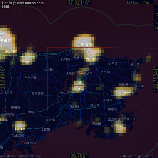
» NASA, Earths city lights 1995
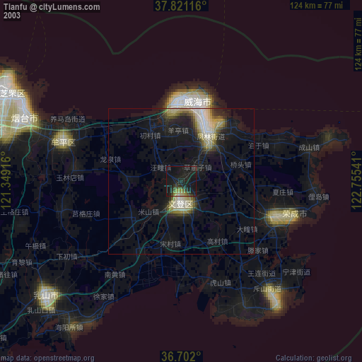
» NASA city lights 2003
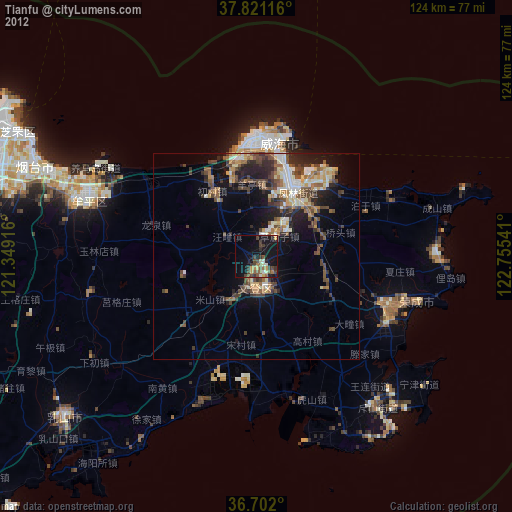
» Earth at Night: Flat Maps 2012, 2016