Zhuangyuan night lights from space
Night Light of Zhuangyuan (Shandong) from space (China) Src. Average luminocity for 10x10km area is 10.724% and for 50x50km: 1.2113%.
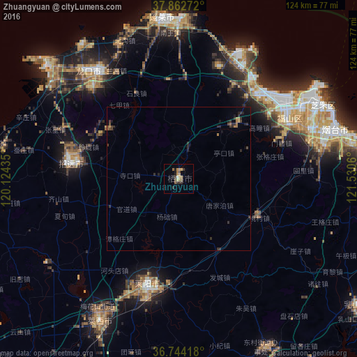
Analysis of Zhuangyuan night lights 2016
Square area 10x10 km:
 0.49%
0.49%90-99
0.16%80-89
1.79%70-79
2.27%60-69
2.92%50-59
1.62%40-49
1.46%30-39
3.08%20-29
0.97%10-19
1.62%0-9
83.6%Square area 50x50 km:
0.02%90-99
0.01%80-89
0.12%70-79
0.16%60-69
0.29%50-59
0.14%40-49
0.22%30-39
0.6%20-29
0.37%10-19
0.36%0-9
97.7%Clear (daylight) street map image can be seen on geolist.org.
Map coordinates:
37° 51' 45.8" North, 120° 7' 27.7" East
37° 18' 19.9" North, 120° 49' 38.9" East
36° 44' 39" North, 121° 31' 50.2" East
Some cities around Zhuangyuan sort by population:
• Yantai
57.4 km =35.7 mi,  70°
70°
• Laiyang
38 km =23.6 mi,  195°
195°
• Zhaoyuan
37.5 km =23.3 mi,  280°
280°
• Dongcun
65.8 km =40.9 mi,  153°
153°
• Dengzhou
56.2 km =34.9 mi,  353°
353°
• Laixi
56.3 km =35 mi,  208°
208°
• Qingyang
43.5 km =27 mi,  60°
60°
• Longgang
58.3 km =36.2 mi,  311°
311°
1797438 (p: 79,106)
Sources (retrieved 2019-11-25):
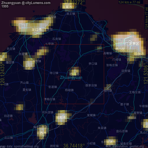
» NASA, Earths city lights 1995
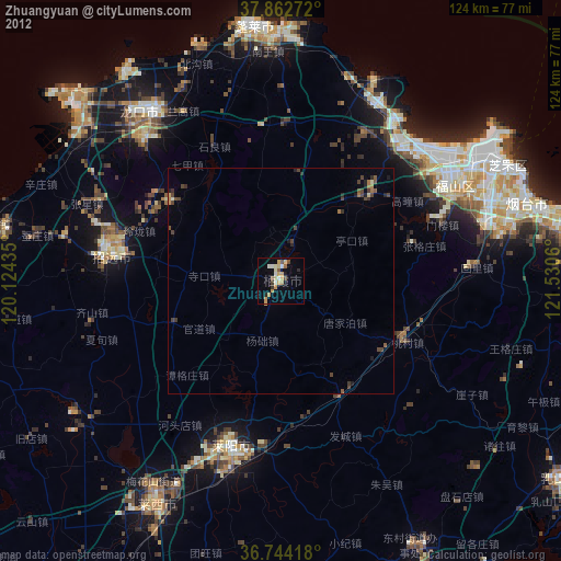
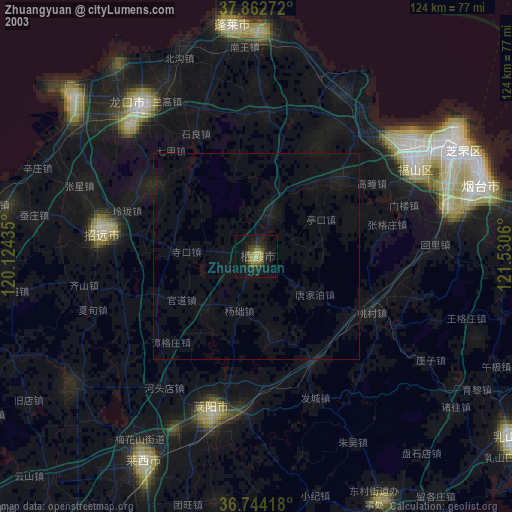
» NASA city lights 2003
» Earth at Night: Flat Maps 2012, 2016