Qionghu night lights from space
Night Light of Qionghu (Hunan) from space (China) Src. Average luminocity for 10x10km area is 4.9053% and for 50x50km: 0.7542%.
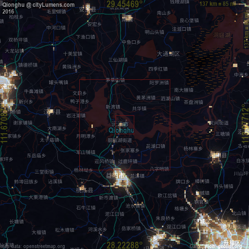
Analysis of Qionghu night lights 2016
Square area 10x10 km:
 0%
0%90-99
0%80-89
0.57%70-79
0.38%60-69
0.57%50-59
0.76%40-49
1.52%30-39
2.65%20-29
3.79%10-19
1.7%0-9
88.07%Square area 50x50 km:
0%90-99
0%80-89
0.09%70-79
0.05%60-69
0.1%50-59
0.1%40-49
0.13%30-39
0.31%20-29
0.35%10-19
0.9%0-9
97.96%Clear (daylight) street map image can be seen on geolist.org.
Map coordinates:
29° 27' 16.9" North, 111° 40' 15.1" East
28° 50' 26.2" North, 112° 22' 26.4" East
28° 13' 22.4" North, 113° 4' 37.6" East
Some cities around Qionghu sort by population:
• Changsha
92.2 km =57.3 mi,  140°
140°
• Yueyang
91.8 km =57 mi,  49°
49°
• Changde
71.5 km =44.4 mi,  288°
288°
• Yiyang
28.3 km =17.6 mi,  189°
189°
• Anxiang
65.9 km =40.9 mi,  340°
340°
• Wenxing
52.3 km =32.5 mi,  109°
109°
• Yutan
67.3 km =41.8 mi,  164°
164°
• Nanzhou
57.8 km =35.9 mi,  2°
2°
1797543 (p: 66,145)
Sources (retrieved 2019-11-25):
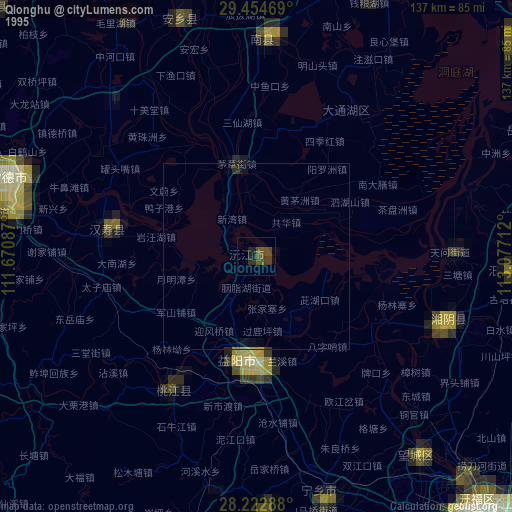
» NASA, Earths city lights 1995
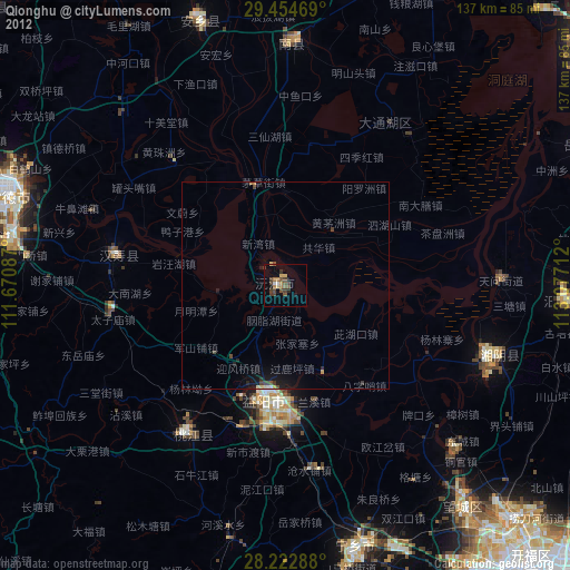
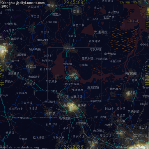
» NASA city lights 2003
» Earth at Night: Flat Maps 2012, 2016