Huangshi night lights from space
Night Light of Huangshi (Hubei) from space (China) Src. Average luminocity for 10x10km area is 48.2045% and for 50x50km: 15.1768%.
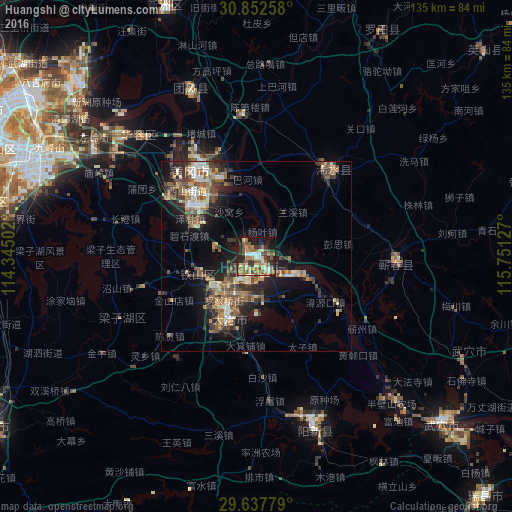

Analysis of Huangshi night lights 2016
Square area 10x10 km:
 4.55%
4.55%90-99
5.24%80-89
9.09%70-79
8.74%60-69
8.92%50-59
13.46%40-49
6.12%30-39
7.87%20-29
13.46%10-19
18.53%0-9
4.02%Square area 50x50 km:
1.16%90-99
1.84%80-89
1.9%70-79
2.01%60-69
2.82%50-59
3.05%40-49
2.96%30-39
2.8%20-29
5.14%10-19
8.67%0-9
67.64%Clear (daylight) street map image can be seen on geolist.org.
Map coordinates:
30° 51' 9.3" North, 114° 20' 42.1" East
30° 14' 49.4" North, 115° 2' 53.3" East
29° 38' 16" North, 115° 45' 4.6" East
Some cities around Huangshi sort by population:
• Wuhan
83.7 km =52 mi,  296°
296°
• Wuxue
65.6 km =40.8 mi,  132°
132°
• Ezhou
26.7 km =16.6 mi,  309°
309°
• Xianning
83.1 km =51.6 mi,  237°
237°
• Xinzhou
72.9 km =45.3 mi,  340°
340°
• Qingquan
30.2 km =18.8 mi,  41°
41°
• Caohe
37.1 km =23.1 mi,  92°
92°
• Daye
20.5 km =12.7 mi,  207°
207°
1807234 (p: 688,090)
Sources (retrieved 2019-11-25):
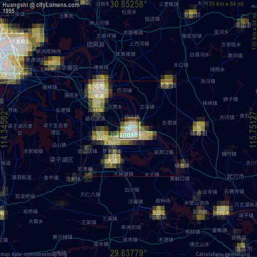
» NASA, Earths city lights 1995
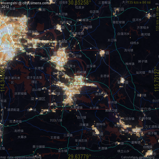
» NASA city lights 2003
» Earth at Night: Flat Maps 2012, 2016