Daye night lights from space
Night Light of Daye (Hubei) from space (China) Src. Average luminocity for 10x10km area is 37.4072% and for 50x50km: 9.7319%.
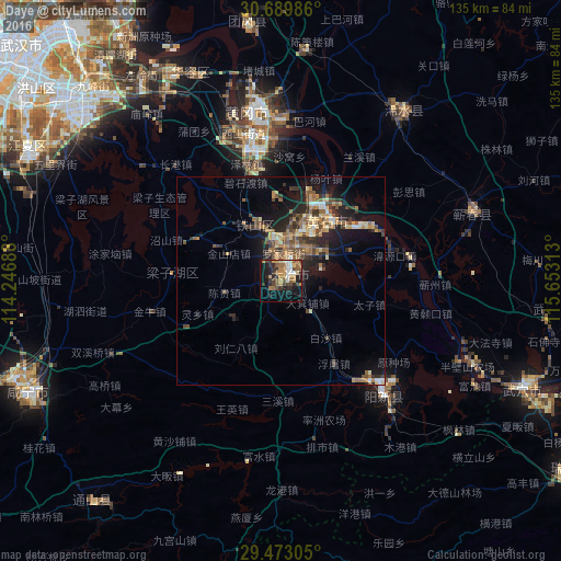
Analysis of Daye night lights 2016
Square area 10x10 km:
 3.6%
3.6%90-99
5.49%80-89
3.22%70-79
8.52%60-69
7.01%50-59
5.87%40-49
6.82%30-39
6.25%20-29
12.5%10-19
19.51%0-9
21.21%Square area 50x50 km:
0.48%90-99
1.01%80-89
1.19%70-79
1.4%60-69
1.9%50-59
2.08%40-49
1.9%30-39
1.74%20-29
3.33%10-19
6.54%0-9
78.41%Clear (daylight) street map image can be seen on geolist.org.
Map coordinates:
30° 41' 23.5" North, 114° 14' 48.8" East
30° 4' 60" North, 114° 57' 0" East
29° 28' 23" North, 115° 39' 11.3" East
Some cities around Daye sort by population:
• Wuhan
86 km =53.4 mi,  310°
310°
• Huangshi
20.5 km =12.7 mi,  27°
27°
• Wuxue
63.5 km =39.5 mi,  114°
114°
• Ezhou
37 km =23 mi,  342°
342°
• Xianning
66.1 km =41.1 mi,  246°
246°
• Huangzhou
43.2 km =26.8 mi, 340°
• Qingquan
50.4 km =31.3 mi,  35°
35°
• Caohe
49.2 km =30.6 mi,  70°
70°
1813206 (p: 61,847)
Sources (retrieved 2019-11-25):
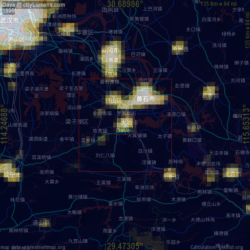
» NASA, Earths city lights 1995
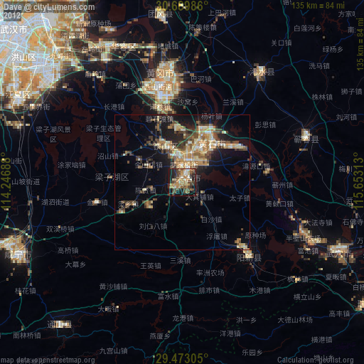
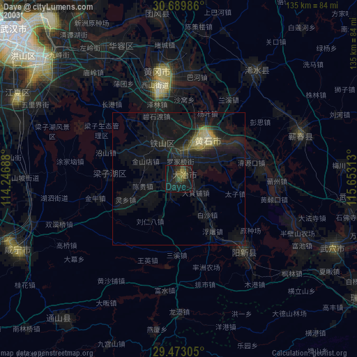
» NASA city lights 2003
» Earth at Night: Flat Maps 2012, 2016