Wuhan night lights from space
Night Light of Wuhan (Hubei) from space (China) Src. Average luminocity for 10x10km area is 98.6465% and for 50x50km: 60.8116%.
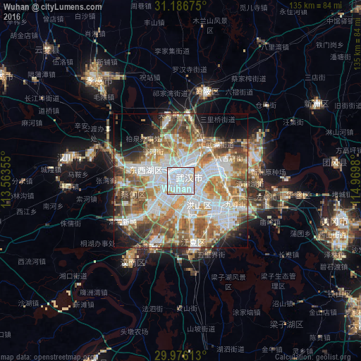
Analysis of Wuhan night lights 2016
Square area 10x10 km:
 70.7%
70.7%90-99
24.18%80-89
3.85%70-79
1.28%60-69
0%50-59
0%40-49
0%30-39
0%20-29
0%10-19
0%0-9
0%Square area 50x50 km:
16.68%90-99
14.1%80-89
7.03%70-79
7.2%60-69
8.54%50-59
10.49%40-49
8.63%30-39
4.99%20-29
4.74%10-19
6.18%0-9
11.4%Clear (daylight) street map image can be seen on geolist.org.
Map coordinates:
31° 11' 12.3" North, 113° 33' 48.8" East
30° 34' 60" North, 114° 16' 0" East
29° 58' 34.1" North, 114° 58' 11.3" East
Some cities around Wuhan sort by population:
• Ezhou
58 km =36 mi,  110°
110°
• Xiaogan
50.4 km =31.3 mi,  319°
319°
• Huangzhou
53.2 km =33.1 mi, 106°
• Hanchuan
48.4 km =30.1 mi,  278°
278°
• Xinzhou
59.9 km =37.2 mi,  58°
58°
• Caidian
22.3 km =13.9 mi,  270°
270°
• Yunmeng Chengguanzhen
71.6 km =44.5 mi, 318°
• Huangpi
35.1 km =21.8 mi,  17°
17°
1791247 (p: 9,785,388)
Sources (retrieved 2019-11-25):
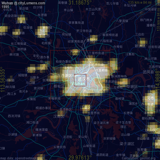
» NASA, Earths city lights 1995
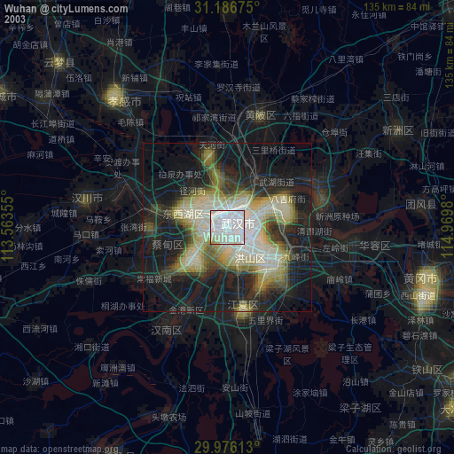
» NASA city lights 2003
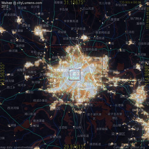
» Earth at Night: Flat Maps 2012, 2016