Caohe night lights from space
Night Light of Caohe (Hubei) from space (China) Src. Average luminocity for 10x10km area is 7.292% and for 50x50km: 1.2692%.
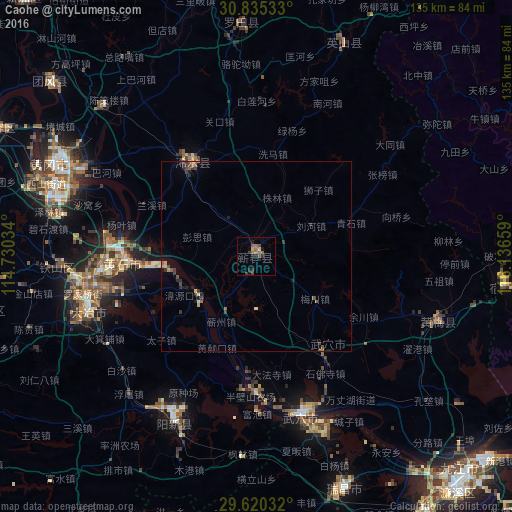
Analysis of Caohe night lights 2016
Square area 10x10 km:
 0%
0%90-99
0%80-89
0.7%70-79
0.7%60-69
1.4%50-59
3.32%40-49
2.27%30-39
1.92%20-29
1.57%10-19
3.5%0-9
84.62%Square area 50x50 km:
0.01%90-99
0.01%80-89
0.17%70-79
0.14%60-69
0.17%50-59
0.39%40-49
0.31%30-39
0.37%20-29
0.44%10-19
0.37%0-9
97.61%Clear (daylight) street map image can be seen on geolist.org.
Map coordinates:
30° 50' 7.2" North, 114° 43' 49.2" East
30° 13' 46.9" North, 115° 26' 0.5" East
29° 37' 13.2" North, 116° 8' 11.7" East
Some cities around Caohe sort by population:
• Huangshi
37.1 km =23.1 mi,  272°
272°
• Jiujiang
80 km =49.7 mi,  136°
136°
• Wuxue
43.7 km =27.2 mi,  164°
164°
• Ezhou
60.6 km =37.7 mi,  288°
288°
• Huangzhou
65.5 km =40.7 mi, 291°
• Huangmei
57 km =35.4 mi,  94°
94°
• Qingquan
29.9 km =18.6 mi,  325°
325°
• Daye
49.2 km =30.6 mi,  250°
250°
1816026 (p: 67,370)
Sources (retrieved 2019-11-25):
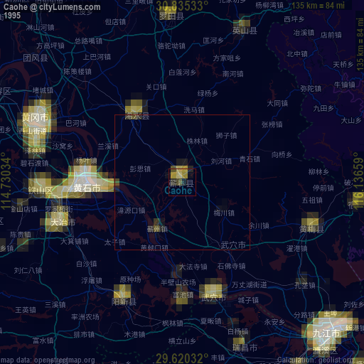
» NASA, Earths city lights 1995
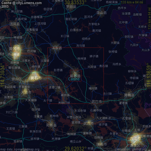
» NASA city lights 2003
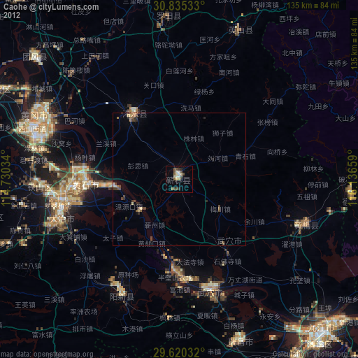
» Earth at Night: Flat Maps 2012, 2016