Datong night lights from space
Night Light of Datong (Shanxi) from space (China) Src. Average luminocity for 10x10km area is 88.0422% and for 50x50km: 16.5753%.
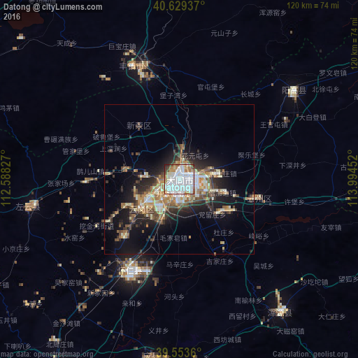
Analysis of Datong night lights 2016
Square area 10x10 km:
 46.1%
46.1%90-99
23.7%80-89
4.87%70-79
7.47%60-69
7.79%50-59
2.76%40-49
3.57%30-39
1.46%20-29
2.27%10-19
0%0-9
0%Square area 50x50 km:
2.65%90-99
2.91%80-89
1.95%70-79
1.82%60-69
2.67%50-59
1.98%40-49
2.45%30-39
3.03%20-29
4.12%10-19
9.2%0-9
67.22%Clear (daylight) street map image can be seen on geolist.org.
Map coordinates:
40° 37' 45.7" North, 112° 35' 17.8" East
40° 5' 37" North, 113° 17' 29" East
39° 33' 13" North, 113° 59' 40.3" East
Some cities around Datong sort by population:
• Hohhot
160 km =99.4 mi,  299°
299°
• Zhangjiakou
156.2 km =97.1 mi,  59°
59°
• Zhangjiakou Shi Xuanhua Qu
159.3 km =99 mi,  68°
68°
• Jining
105 km =65.2 mi,  351°
351°
• Xinzhou
193.4 km =120.2 mi,  194°
194°
• Dingzhou
228.9 km =142.2 mi,  140°
140°
• Yuanping
160 km =99.4 mi,  196°
196°
• Beichengqu
40.2 km =25 mi,  343°
343°
2037799 (p: 1,052,678)
Sources (retrieved 2019-11-25):
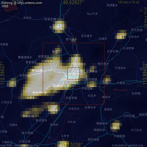
» NASA, Earths city lights 1995
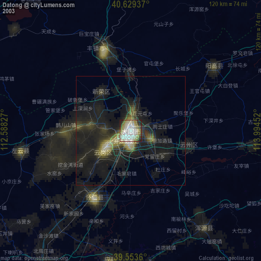
» NASA city lights 2003
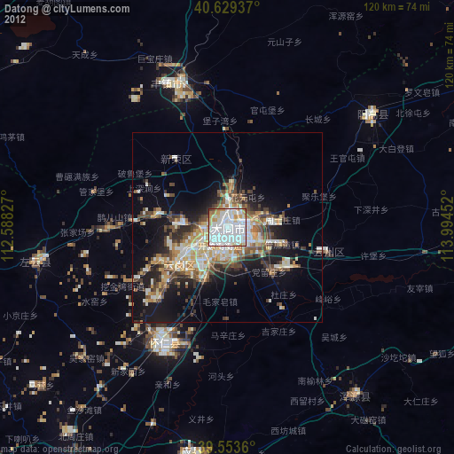
» Earth at Night: Flat Maps 2012, 2016