Zhangjiakou night lights from space
Night Light of Zhangjiakou (Hebei) from space (China) Src. Average luminocity for 10x10km area is 62.4813% and for 50x50km: 9.8874%.
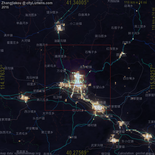
Analysis of Zhangjiakou night lights 2016
Square area 10x10 km:
 16.84%
90-99
17.52%80-89
6.12%70-79
3.23%60-69
6.12%50-59
9.86%40-49
10.54%30-39
7.99%20-29
12.76%10-19
8.5%0-9
0.51%Square area 50x50 km:
1.39%90-99
1.67%80-89
1.35%70-79
0.92%60-69
0.99%50-59
1.6%40-49
1.72%30-39
1.5%20-29
2.84%10-19
7.25%0-9
78.76%Clear (daylight) street map image can be seen on geolist.org.
Map coordinates:
41° 20' 24.2" North, 114° 10' 34.8" East
40° 48' 36" North, 114° 52' 46" East
40° 16' 32.5" North, 115° 34' 57.3" East
Some cities around Zhangjiakou sort by population:
• Beijing
163.1 km =101.3 mi,  127°
127°
• Datong
156.2 km =97.1 mi,  239°
239°
• Jining
151 km =93.8 mi,  279°
279°
• Mentougou
141.3 km =87.8 mi, 133°
• Fangshan
156.8 km =97.4 mi,  142°
142°
• Changping
132.2 km =82.1 mi,  119°
119°
• Liangxiang
159.9 km =99.4 mi, 138°
• Beichengqu
151.4 km =94.1 mi,  254°
254°
2033196 (p: 692,602)
Sources (retrieved 2019-11-25):
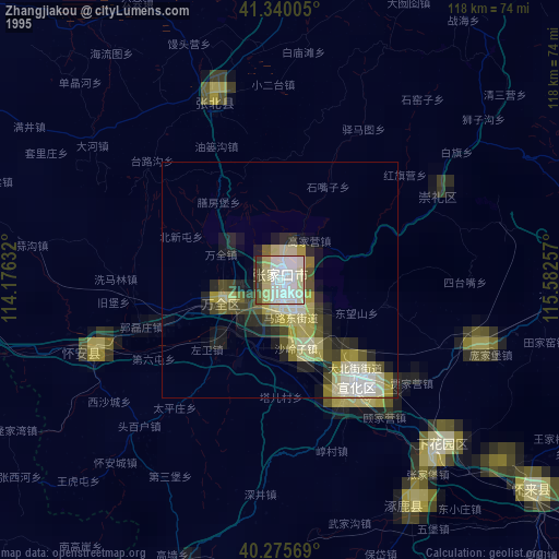
» NASA, Earths city lights 1995
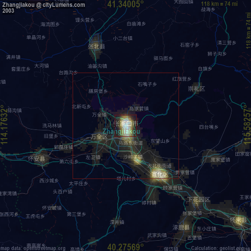
» NASA city lights 2003
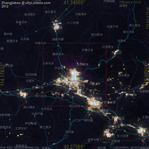
» Earth at Night: Flat Maps 2012, 2016