Chizhou night lights from space
Night Light of Chizhou (Anhui) from space (China) Src. Average luminocity for 10x10km area is 41.6311% and for 50x50km: 4.0197%.
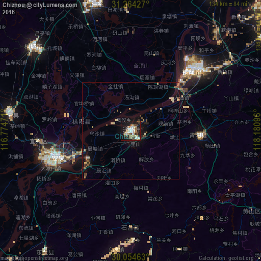
Analysis of Chizhou night lights 2016
Square area 10x10 km:
 5.94%
5.94%90-99
8.22%80-89
8.22%70-79
2.62%60-69
6.82%50-59
4.2%40-49
8.57%30-39
2.45%20-29
6.99%10-19
36.01%0-9
9.97%Square area 50x50 km:
0.3%90-99
0.49%80-89
0.83%70-79
0.33%60-69
0.53%50-59
0.38%40-49
0.8%30-39
0.39%20-29
0.86%10-19
3.47%0-9
91.62%Clear (daylight) street map image can be seen on geolist.org.
Map coordinates:
31° 15' 51.4" North, 116° 46' 29" East
30° 39' 40.8" North, 117° 28' 40.2" East
30° 3' 16.7" North, 118° 10' 51.5" East
Some cities around Chizhou sort by population:
• Hefei
135 km =83.9 mi,  352°
352°
• Wuhu
113.7 km =70.6 mi,  48°
48°
• Anqing
44.4 km =27.6 mi,  248°
248°
• Wusong
43.4 km =27 mi,  42°
42°
• Chaohu
110.7 km =68.8 mi,  19°
19°
• Xuanzhou
126.2 km =78.4 mi,  75°
75°
• Lucheng
66.3 km =41.2 mi,  343°
343°
• Huangshan
132.6 km =82.4 mi,  142°
142°
1814934 (p: 148,375)
Sources (retrieved 2019-11-25):
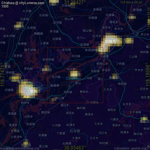
» NASA, Earths city lights 1995
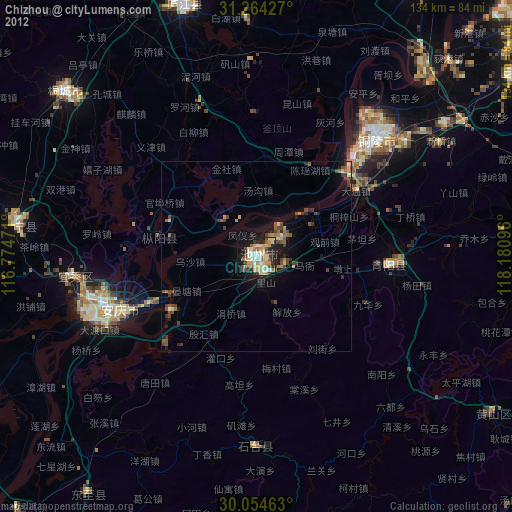
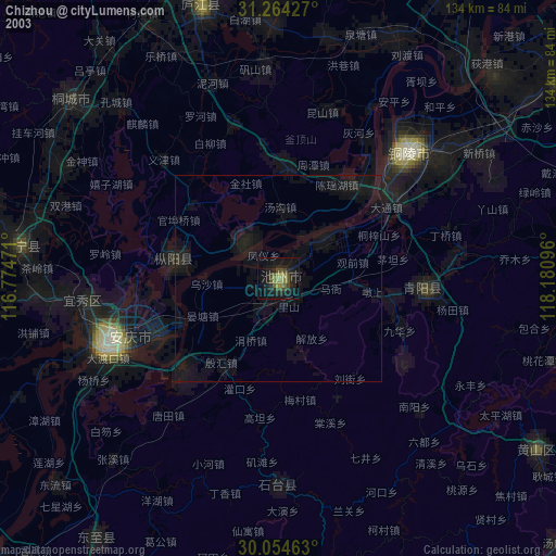
» NASA city lights 2003
» Earth at Night: Flat Maps 2012, 2016