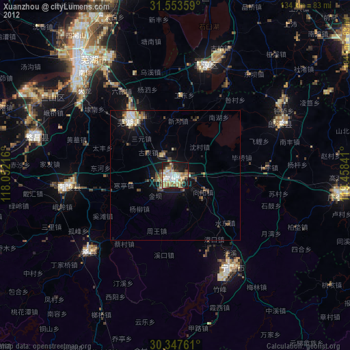
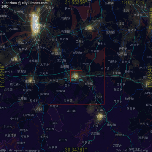
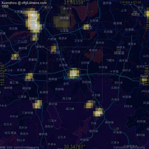
Xuanzhou night lights from space
Night Light of Xuanzhou (Anhui) from space (China) Src. Average luminocity for 10x10km area is 53.3425% and for 50x50km: 6.2891%.
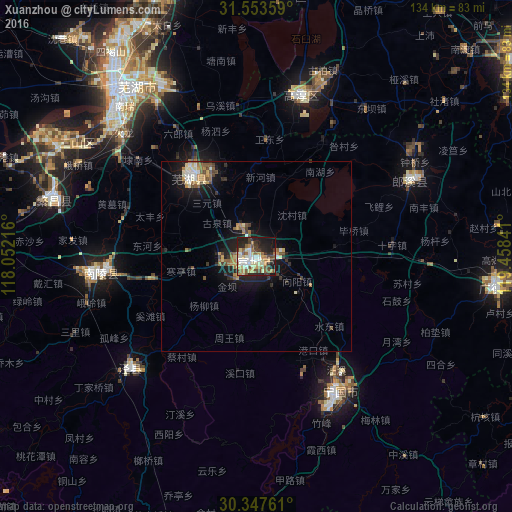
Analysis of Xuanzhou night lights 2016
Square area 10x10 km:
 6.41%
6.41%90-99
11.36%80-89
11.36%70-79
7.69%60-69
5.86%50-59
7.88%40-49
7.33%30-39
8.42%20-29
15.75%10-19
16.3%0-9
1.65%Square area 50x50 km:
0.51%90-99
0.97%80-89
0.91%70-79
0.78%60-69
0.97%50-59
0.93%40-49
0.84%30-39
1.01%20-29
1.84%10-19
4.79%0-9
86.45%Clear (daylight) street map image can be seen on geolist.org.
Map coordinates:
31° 33' 12.9" North, 118° 3' 7.8" East
30° 57' 9" North, 118° 45' 19" East
30° 20' 51.4" North, 119° 27' 30.3" East
Some cities around Xuanzhou sort by population:
• Wuhu
56.1 km =34.9 mi,  319°
319°
• Wusong
92.7 km =57.6 mi,  269°
269°
• Chaohu
111 km =69 mi,  310°
310°
• Yicheng
111 km =69 mi,  65°
65°
• Licheng
87.1 km =54.1 mi,  52°
52°
• Zhicheng
110.1 km =68.4 mi,  86°
86°
• Gushu
72.4 km =45 mi,  338°
338°
• Hutang
95.2 km =59.2 mi, 47°
1788081 (p: 127,758)
Sources (retrieved 2019-11-25):
» NASA, Earths city lights 1995
» NASA city lights 2003
» Earth at Night: Flat Maps 2012, 2016