Hefei night lights from space
Night Light of Hefei (Anhui) from space (China) Src. Average luminocity for 10x10km area is 99.1777% and for 50x50km: 40.1302%.
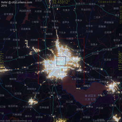
Analysis of Hefei night lights 2016
Square area 10x10 km:
 80.59%
90-99
16.48%80-89
2.38%70-79
0.55%60-69
0%50-59
0%40-49
0%30-39
0%20-29
0%10-19
0%0-9
0%Square area 50x50 km:
15.61%90-99
9.07%80-89
3.02%70-79
3.04%60-69
2.8%50-59
3.39%40-49
4.31%30-39
3.99%20-29
6.59%10-19
10.69%0-9
37.49%Clear (daylight) street map image can be seen on geolist.org.
Map coordinates:
32° 27' 32.8" North, 116° 34' 39.8" East
31° 51' 50" North, 117° 16' 51" East
31° 15' 53.3" North, 117° 59' 2.3" East
Some cities around Hefei sort by population:
• Huainan
88.9 km =55.2 mi,  342°
342°
• Wusong
112.2 km =69.7 mi,  154°
154°
• Chuzhou
108.5 km =67.4 mi,  62°
62°
• Chaohu
62.7 km =39 mi,  117°
117°
• Lucheng
70.1 km =43.6 mi,  180°
180°
• Wuyang
98.6 km =61.3 mi,  278°
278°
• Huoqiu Chengguanzhen
107.8 km =67 mi,  300°
300°
• Datong
86.6 km =53.8 mi,  346°
346°
1808722 (p: 3,310,268)
Sources (retrieved 2019-11-25):
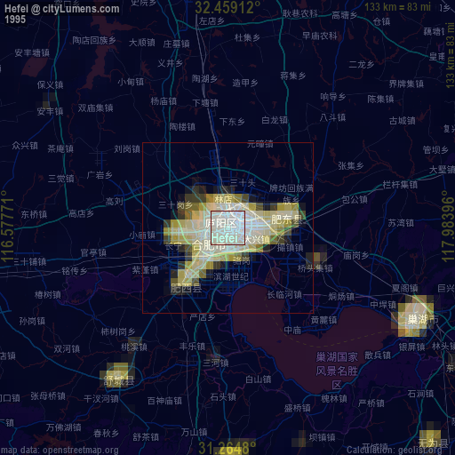
» NASA, Earths city lights 1995
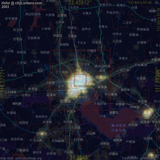
» NASA city lights 2003
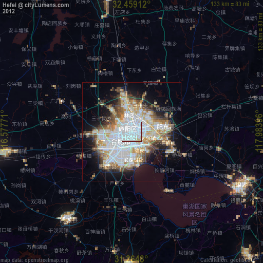
» Earth at Night: Flat Maps 2012, 2016