Huangshan night lights from space
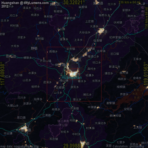
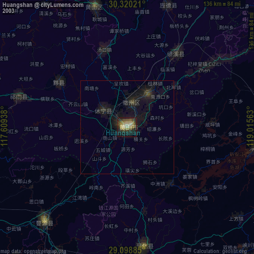
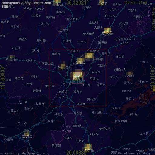
Night Light of Huangshan (Anhui) from space (China) Src. Average luminocity for 10x10km area is 33.6012% and for 50x50km: 2.4653%.
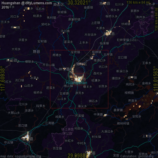
Analysis of Huangshan night lights 2016
Square area 10x10 km:
 2.38%
2.38%90-99
5.75%80-89
5.75%70-79
4.37%60-69
5.75%50-59
4.56%40-49
7.14%30-39
2.38%20-29
4.37%10-19
38.89%0-9
18.65%Square area 50x50 km:
0.09%90-99
0.26%80-89
0.3%70-79
0.29%60-69
0.32%50-59
0.44%40-49
0.67%30-39
0.24%20-29
0.63%10-19
2.43%0-9
94.33%Clear (daylight) street map image can be seen on geolist.org.
Map coordinates:
30° 19' 12.8" North, 117° 36' 33.8" East
29° 42' 41" North, 118° 18' 45" East
29° 5' 55.9" North, 119° 0' 56.3" East
Some cities around Huangshan sort by population:
• Shangrao
144.6 km =89.9 mi,  194°
194°
• Jingdezhen
116.5 km =72.4 mi,  246°
246°
• Chizhou
132.6 km =82.4 mi,  322°
322°
• Jinhua
145.5 km =90.4 mi,  117°
117°
• Xuanzhou
144.4 km =89.7 mi,  17°
17°
• Quzhou
99.5 km =61.8 mi,  147°
147°
• Lanxi
125 km =77.7 mi, 116°
• Wucheng
18.1 km =11.2 mi,  227°
227°
1792359 (p: 77,000)
Sources (retrieved 2019-11-25):
» NASA, Earths city lights 1995
» NASA city lights 2003
» Earth at Night: Flat Maps 2012, 2016