Chaohu night lights from space
Night Light of Chaohu (Anhui) from space (China) Src. Average luminocity for 10x10km area is 64.956% and for 50x50km: 6.0576%.
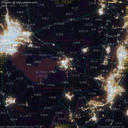

Analysis of Chaohu night lights 2016
Square area 10x10 km:
 16.85%
90-99
15.75%80-89
9.89%70-79
7.51%60-69
4.21%50-59
9.16%40-49
10.26%30-39
7.69%20-29
12.09%10-19
6.23%0-9
0.37%Square area 50x50 km:
0.9%90-99
0.98%80-89
0.82%70-79
0.51%60-69
0.59%50-59
0.62%40-49
1.06%30-39
1.1%20-29
1.91%10-19
3.98%0-9
87.53%Clear (daylight) street map image can be seen on geolist.org.
Map coordinates:
32° 11' 49" North, 117° 9' 48.8" East
31° 36' 0" North, 117° 52' 0" East
30° 59' 57.2" North, 118° 34' 11.3" East
Some cities around Chaohu sort by population:
• Nanjing
100.2 km =62.3 mi,  59°
59°
• Hefei
62.7 km =39 mi,  297°
297°
• Wuhu
56.2 km =34.9 mi,  121°
121°
• Wusong
72.7 km =45.2 mi,  186°
186°
• Chuzhou
90 km =55.9 mi,  26°
26°
• Lucheng
68.9 km =42.8 mi,  233°
233°
• Xiaolingwei
104.9 km =65.2 mi, 62°
• Gushu
58.4 km =36.3 mi,  94°
94°
1815427 (p: 138,463)
Sources (retrieved 2019-11-25):
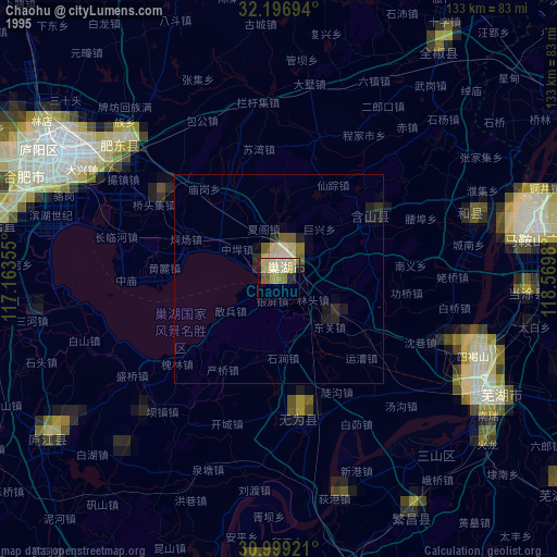
» NASA, Earths city lights 1995
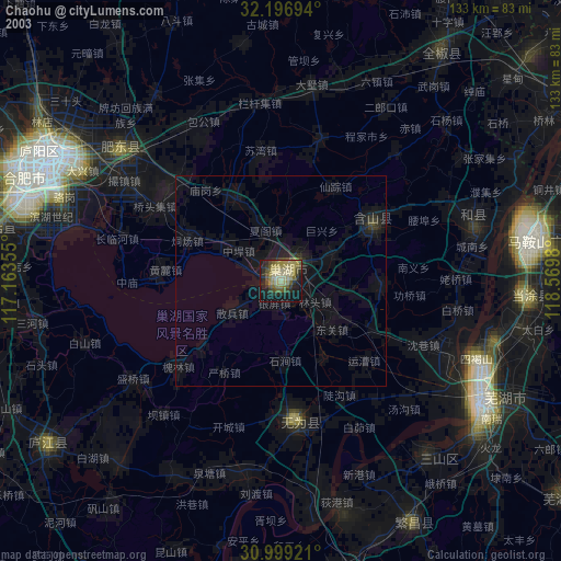
» NASA city lights 2003
» Earth at Night: Flat Maps 2012, 2016