Anda night lights from space
Night Light of Anda (Heilongjiang) from space (China) Src. Average luminocity for 10x10km area is 17.6771% and for 50x50km: 9.5888%.
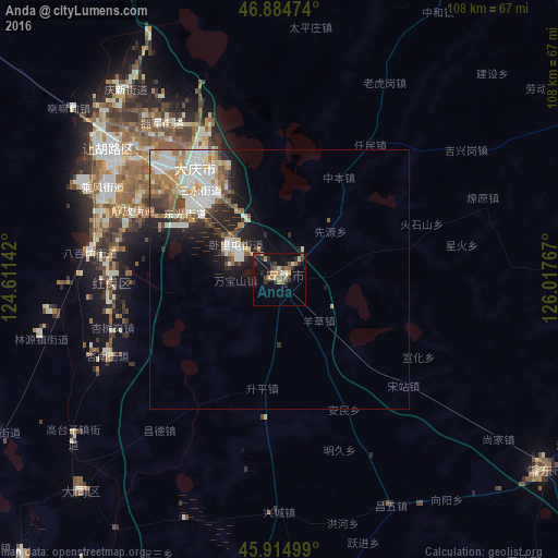
Analysis of Anda night lights 2016
Square area 10x10 km:
 0.3%
0.3%90-99
0.89%80-89
2.08%70-79
3.87%60-69
2.53%50-59
3.57%40-49
2.83%30-39
3.57%20-29
6.1%10-19
13.69%0-9
60.57%Square area 50x50 km:
1.85%90-99
2.49%80-89
0.79%70-79
1.3%60-69
1.16%50-59
1.24%40-49
1.04%30-39
0.95%20-29
2.28%10-19
4.1%0-9
82.82%Clear (daylight) street map image can be seen on geolist.org.
Map coordinates:
46° 53' 5.1" North, 124° 36' 41.1" East
46° 24' 7.3" North, 125° 18' 52.3" East
45° 54' 54" North, 126° 1' 3.6" East
Some cities around Anda sort by population:
• Fendou
43.6 km =27.1 mi,  307°
307°
• Daqing
31.4 km =19.5 mi, 309°
• Zhaodong
63.4 km =39.4 mi,  125°
125°
• Longfeng
21.6 km =13.4 mi, 311°
• Honggang
33.1 km =20.6 mi,  269°
269°
• Lanxi
76 km =47.2 mi,  102°
102°
• Qinggang
68.2 km =42.4 mi,  62°
62°
• Zhaozhou
79.9 km =49.6 mi,  179°
179°
2038650 (p: 181,271)
Sources (retrieved 2019-11-25):
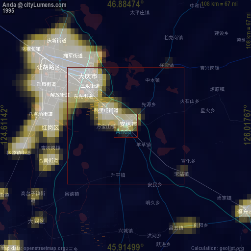
» NASA, Earths city lights 1995
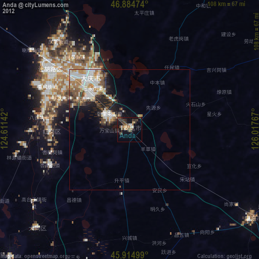
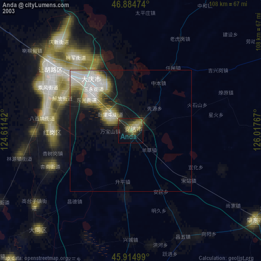
» NASA city lights 2003
» Earth at Night: Flat Maps 2012, 2016