Lanxi night lights from space
Night Light of Lanxi (Heilongjiang) from space (China) Src. Average luminocity for 10x10km area is 4.9137% and for 50x50km: 0.722%.
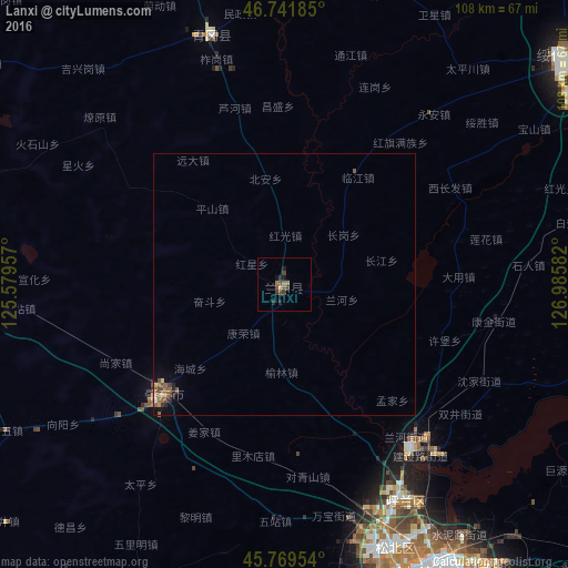
Analysis of Lanxi night lights 2016
Square area 10x10 km:
 0%
0%90-99
0%80-89
0%70-79
0.6%60-69
1.19%50-59
1.04%40-49
2.38%30-39
2.08%20-29
2.08%10-19
1.34%0-9
89.29%Square area 50x50 km:
0%90-99
0.02%80-89
0.09%70-79
0.05%60-69
0.17%50-59
0.23%40-49
0.28%30-39
0.14%20-29
0.2%10-19
0.15%0-9
98.66%Clear (daylight) street map image can be seen on geolist.org.
Map coordinates:
46° 44' 30.7" North, 125° 34' 46.5" East
46° 15' 28.3" North, 126° 16' 57.7" East
45° 46' 10.3" North, 126° 59' 9" East
Some cities around Lanxi sort by population:
• Harbin
63.2 km =39.3 mi,  153°
153°
• Suihua
69.1 km =42.9 mi,  52°
52°
• Anda
76 km =47.2 mi,  282°
282°
• Zhaodong
31.3 km =19.4 mi,  227°
227°
• Hulan
39.1 km =24.3 mi,  141°
141°
• Wangkui
65.6 km =40.8 mi,  13°
13°
• Qinggang
49.4 km =30.7 mi,  344°
344°
• Bayan
88.3 km =54.9 mi,  103°
103°
2036226 (p: 72,528)
Sources (retrieved 2019-11-25):
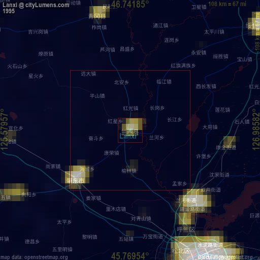
» NASA, Earths city lights 1995
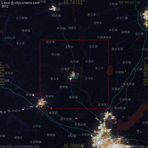
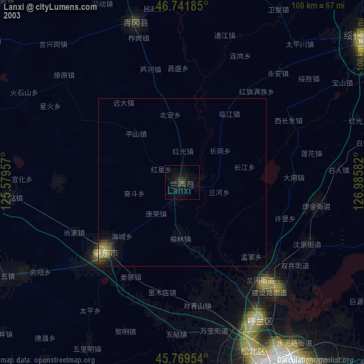
» NASA city lights 2003
» Earth at Night: Flat Maps 2012, 2016