Fendou night lights from space
Night Light of Fendou (Heilongjiang) from space (China) Src. Average luminocity for 10x10km area is 60.2017% and for 50x50km: 22.0559%.
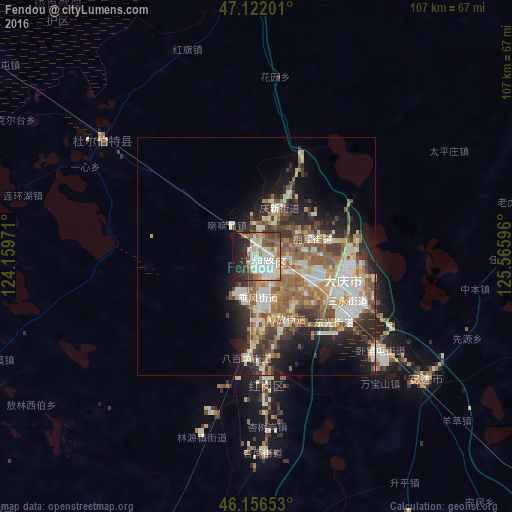
Analysis of Fendou night lights 2016
Square area 10x10 km:
 15.77%
90-99
19.03%80-89
4.69%70-79
3.98%60-69
6.96%50-59
8.66%40-49
5.54%30-39
6.53%20-29
12.07%10-19
13.49%0-9
3.27%Square area 50x50 km:
3.25%90-99
5.22%80-89
2.23%70-79
2.61%60-69
3.39%50-59
4.36%40-49
3.22%30-39
3.48%20-29
4.97%10-19
7.48%0-9
59.78%Clear (daylight) street map image can be seen on geolist.org.
Map coordinates:
47° 7' 19.2" North, 124° 9' 35" East
46° 38' 29.1" North, 124° 51' 46.2" East
46° 9' 23.5" North, 125° 33' 57.5" East
Some cities around Fendou sort by population:
• Qiqihar
103.6 km =64.4 mi,  318°
318°
• Daqing
12.3 km =7.6 mi,  121°
121°
• Anda
43.6 km =27.1 mi,  127°
127°
• Longfeng
22.1 km =13.7 mi, 123°
• Honggang
26.8 km =16.7 mi,  176°
176°
• Qinggang
95 km =59 mi,  87°
87°
• Mingshui
99.1 km =61.6 mi,  52°
52°
• Taikang
40.3 km =25 mi,  307°
307°
2035225 (p: 226,298)
Sources (retrieved 2019-11-25):
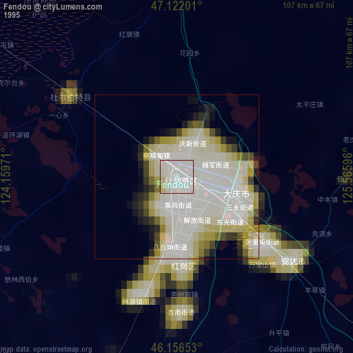
» NASA, Earths city lights 1995
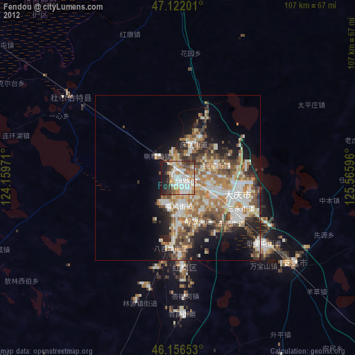
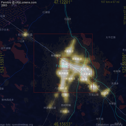
» NASA city lights 2003
» Earth at Night: Flat Maps 2012, 2016