Longfeng night lights from space
Night Light of Longfeng (Heilongjiang) from space (China) Src. Average luminocity for 10x10km area is 70.9702% and for 50x50km: 24.9295%.
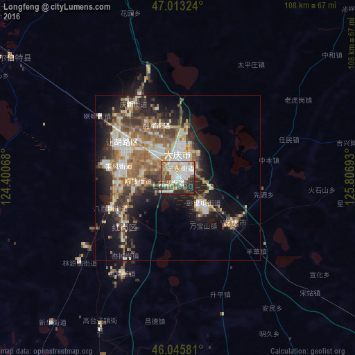

Analysis of Longfeng night lights 2016
Square area 10x10 km:
 17.33%
90-99
26.7%80-89
3.98%70-79
7.67%60-69
7.53%50-59
8.1%40-49
8.52%30-39
7.67%20-29
11.79%10-19
0.71%0-9
0%Square area 50x50 km:
3.49%90-99
5.68%80-89
2.46%70-79
3%60-69
3.64%50-59
4.87%40-49
3.62%30-39
3.83%20-29
6%10-19
10.87%0-9
52.56%Clear (daylight) street map image can be seen on geolist.org.
Map coordinates:
47° 0' 47.7" North, 124° 24' 2.4" East
46° 31' 54" North, 125° 6' 13.7" East
46° 2' 44.9" North, 125° 48' 24.9" East
Some cities around Longfeng sort by population:
• Fendou
22.1 km =13.7 mi,  303°
303°
• Daqing
9.8 km =6.1 mi,  305°
305°
• Anda
21.6 km =13.4 mi,  131°
131°
• Zhaodong
85 km =52.8 mi, 127°
• Honggang
22.3 km =13.9 mi,  229°
229°
• Qinggang
78.4 km =48.7 mi,  77°
77°
• Mingshui
94.3 km =58.6 mi,  39°
39°
• Taikang
62.4 km =38.8 mi, 305°
2035980 (p: 152,074)
Sources (retrieved 2019-11-25):
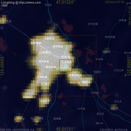
» NASA, Earths city lights 1995
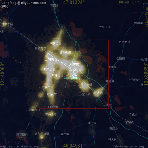
» NASA city lights 2003
» Earth at Night: Flat Maps 2012, 2016