Zhaodong night lights from space
Night Light of Zhaodong (Heilongjiang) from space (China) Src. Average luminocity for 10x10km area is 15.9645% and for 50x50km: 0.9656%.
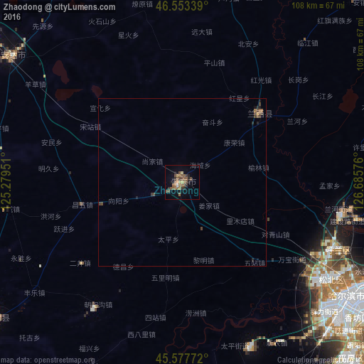
Analysis of Zhaodong night lights 2016
Square area 10x10 km:
 0%
0%90-99
0.57%80-89
2.13%70-79
0.71%60-69
3.55%50-59
6.39%40-49
5.4%30-39
1.99%20-29
3.27%10-19
4.83%0-9
71.16%Square area 50x50 km:
0%90-99
0.02%80-89
0.09%70-79
0.05%60-69
0.2%50-59
0.31%40-49
0.4%30-39
0.21%20-29
0.27%10-19
0.28%0-9
98.18%Clear (daylight) street map image can be seen on geolist.org.
Map coordinates:
46° 33' 12.2" North, 125° 16' 46.2" East
46° 4' 3.8" North, 125° 58' 57.5" East
45° 34' 39.8" North, 126° 41' 8.7" East
Some cities around Zhaodong sort by population:
• Harbin
62.6 km =38.9 mi,  124°
124°
• Anda
63.4 km =39.4 mi,  305°
305°
• Longfeng
85 km =52.8 mi, 307°
• Shuangcheng
83.1 km =51.6 mi,  163°
163°
• Hulan
48.6 km =30.2 mi,  101°
101°
• Lanxi
31.3 km =19.4 mi,  47°
47°
• Qinggang
69.3 km =43.1 mi,  7°
7°
• Zhaozhou
67 km =41.6 mi,  230°
230°
2033168 (p: 154,406)
Sources (retrieved 2019-11-25):
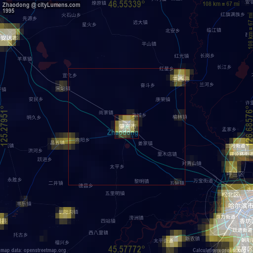
» NASA, Earths city lights 1995
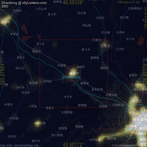
» NASA city lights 2003
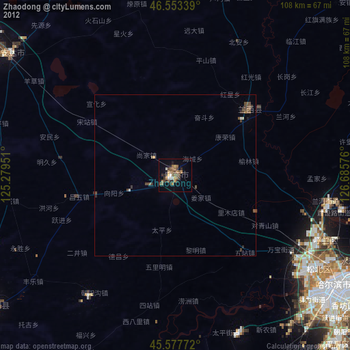
» Earth at Night: Flat Maps 2012, 2016