San Clemente night lights from space
Night Light of San Clemente (Maule Region) from space (Chile) Src. Average luminocity for 10x10km area is 6.7473% and for 50x50km: 5.5877%.
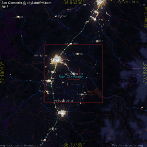
Analysis of San Clemente night lights 2016
Square area 10x10 km:
 0.37%
0.37%90-99
0.73%80-89
0.37%70-79
0.73%60-69
2.93%50-59
0.73%40-49
0.73%30-39
1.83%20-29
0.73%10-19
1.47%0-9
89.38%Square area 50x50 km:
0.52%90-99
0.74%80-89
1.06%70-79
0.67%60-69
0.82%50-59
0.7%40-49
0.49%30-39
0.84%20-29
1.42%10-19
3.75%0-9
88.99%Clear (daylight) street map image can be seen on geolist.org.
Map coordinates:
34° 57' 48.9" South, 72° 11' 24.5" West
35° 32' 16" South, 71° 29' 13.2" West
36° 6' 28.4" South, 70° 47' 2" West
Some cities around San Clemente sort by population:
• Talca
19.6 km =12.2 mi,  309°
309°
• Curicó
65.7 km =40.8 mi,  20°
20°
• Linares
35.7 km =22.2 mi,  195°
195°
• Molina
50.6 km =31.4 mi, 21°
• Parral
73.9 km =45.9 mi, 204°
• San Javier
22.8 km =14.2 mi,  253°
253°
• Rauco
69.8 km =43.4 mi,  12°
12°
• Longaví
50.7 km =31.5 mi, 200°
3872306 (p: 13,656)
Sources (retrieved 2019-11-25):
» Earth at Night: Flat Maps 2012, 2016