Los Andes night lights from space
Night Light of Los Andes (Valparaíso) from space (Chile) Src. Average luminocity for 10x10km area is 42.6136% and for 50x50km: 6.2407%.
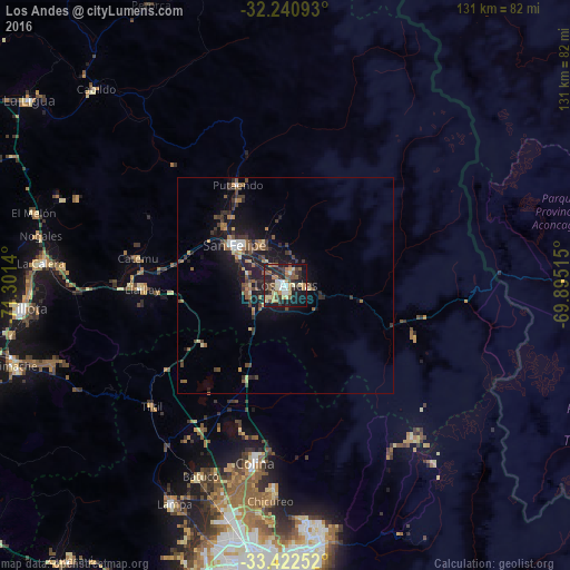
Analysis of Los Andes night lights 2016
Square area 10x10 km:
 4.55%
4.55%90-99
4.9%80-89
7.87%70-79
5.94%60-69
6.12%50-59
8.74%40-49
4.37%30-39
10.31%20-29
16.43%10-19
26.22%0-9
4.55%Square area 50x50 km:
0.39%90-99
0.45%80-89
0.67%70-79
0.64%60-69
0.96%50-59
1.43%40-49
1.07%30-39
1.67%20-29
1.9%10-19
5.69%0-9
85.12%Clear (daylight) street map image can be seen on geolist.org.
Map coordinates:
32° 14' 27.3" South, 71° 18' 5" West
32° 50' 1.3" South, 70° 35' 53.8" West
33° 25' 21.1" South, 69° 53' 42.5" West
Some cities around Los Andes sort by population:
• Lo Prado
68.9 km =42.8 mi,  189°
189°
• Quillota
61 km =37.9 mi,  264°
264°
• San Felipe
15.1 km =9.4 mi,  308°
308°
• Hacienda La Calera
58.1 km =36.1 mi,  275°
275°
• Limache
65.6 km =40.8 mi,  251°
251°
• Lampa
56.6 km =35.2 mi,  207°
207°
• Chicureo Abajo
50.3 km =31.3 mi, 185°
• Llaillay
33.5 km =20.8 mi,  268°
268°
3882434 (p: 56,859)
Sources (retrieved 2019-11-25):
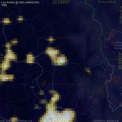
» NASA, Earths city lights 1995
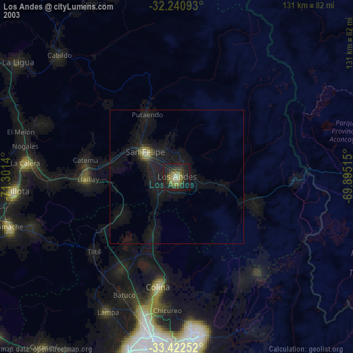
» NASA city lights 2003
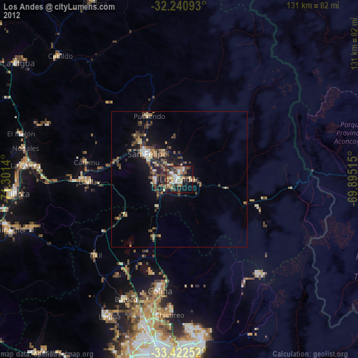
» Earth at Night: Flat Maps 2012, 2016