Lampa night lights from space
Night Light of Lampa (Santiago Metropolitan) from space (Chile) Src. Average luminocity for 10x10km area is 22.7762% and for 50x50km: 25.1749%.
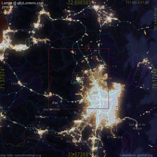
Analysis of Lampa night lights 2016
Square area 10x10 km:
 1.4%
1.4%90-99
2.1%80-89
2.1%70-79
1.57%60-69
5.42%50-59
4.2%40-49
3.5%30-39
4.37%20-29
5.24%10-19
31.82%0-9
38.29%Square area 50x50 km:
7.92%90-99
4.59%80-89
1.97%70-79
2.44%60-69
3.89%50-59
4.11%40-49
2.35%30-39
2.96%20-29
3.54%10-19
6.37%0-9
59.86%Clear (daylight) street map image can be seen on geolist.org.
Map coordinates:
32° 41' 47.6" South, 71° 34' 43.5" West
33° 17' 10.7" South, 70° 52' 32.2" West
33° 52' 19.5" South, 70° 10' 21" West
Some cities around Lampa sort by population:
• Santiago
28.4 km =17.6 mi,  131°
131°
• San Bernardo
37.7 km =23.4 mi,  154°
154°
• La Pintana
39.9 km =24.8 mi, 145°
• Lo Prado
22.4 km =13.9 mi,  141°
141°
• Peñaflor
35.6 km =22.1 mi,  180°
180°
• Talagante
42.3 km =26.3 mi,  186°
186°
• Chicureo Abajo
20.7 km =12.9 mi,  89°
89°
• Villa Presidente Frei, Ñuñoa, Santiago, Chile
33.6 km =20.9 mi, 125°
3885273 (p: 29,250)
Sources (retrieved 2019-11-25):
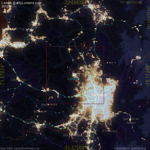
» Earth at Night: Flat Maps 2012, 2016